About Gulf Islands Marine Trail
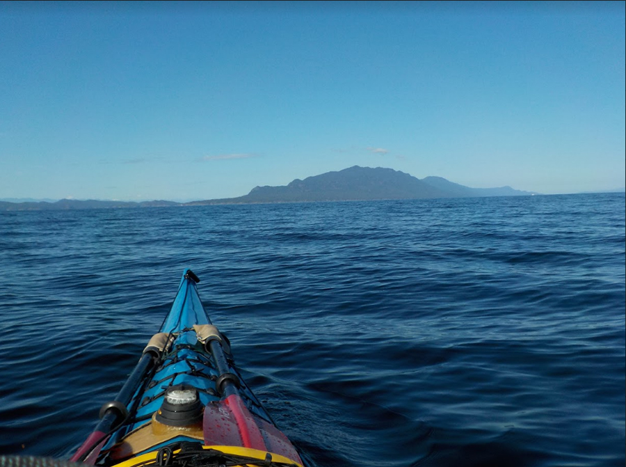
Paddlers are aware of the mystery and beauty of the Gulf Islands long before they dip their paddle in the waters. This popular paddling area echoes well past the shores of the islands. The magic of the Gulf Islands is experienced in many ways: watching river otters play on the sandstone shores, often idyllic paddling conditions and the iconic cries of the Bald Eagles above.

Many of the campsites are in either a BC Provincial Park or the Gulf Islands National Park Reserve. There are dozens of access points located on Vancouver Island and the Gulf Islands. Exploring the Gulf Islands can occur from a number of hub cities or from city, town, or rural launch sites.
The Marine Trail encompasses most of the Gulf Islands from Newcastle Island and Gabriola Island (north end) to Victoria and a number of islands within the Gulf Islands National Park Reserve. Some routes on the outside of Gabriola Island, Valdes and Galiano Islands have fewer sites and do not meet our Marine Trail Safety Mandate (i.e. campsites optimally 8NM apart to a maximum of 12NM apart).
This trail officially opened in 2011 but we continue to work on First Nations engagement, stewardship, and safety within its area.
Plan your Trip
The Gulf Islands Marine Trail or Salish Sea Marine Trail can be enjoyed as one long expedition, but there are plenty of ways to enjoy just portions. We do not give specific trails or routes at this time. It’s best that you choose a gateway or launch point where you wish to start and plan your trip by accessing our map.
Resources
- It’s a good idea to view the overall area on our main map first to get an idea of where you wish to paddle. Choose your location and route.
- Our goal helps ensure safe travelling by canoe or kayak. We completed safety audits of all routes in the Gulf Islands and other stretches of the BC coast to determine where distances are not optimal or safe. For example, the outside of the Gulf Islands – Gabriola Island, Valdes Island and Galiano Island – have long stretches of coastline without ample campsites. That is, campsites optimally should be 8NM apart to a maximum of 12NM.
- If you are new to paddling you have to decide whether you are ready for your first trip. Consider taking paddling lessons and join a local club. Be trained. Be prepared. Be connected.
- As a member you can access our trip resources page or easily find resources online at Sea Kayak Association of BC.
Arriving by Car
The Gulf Islands Marine Trail has several entry points including Nanaimo, Ladysmith, Chemainus, Maple Bay and Mill Bay or you can travel to one of the main Gulf Islands.
Horseshoe Bay to Nanaimo: A BC ferry travels on this route taking a little over one and half hours. You can consider launching into the north end of the Gulf Islands Marine Trail from Brechin boat ramp or nearby launches.
Tsawwassen to Duke Point: A BC ferry travels on this route from Twassawwen to Duke Point in two hours. Access Nanaimo or Ladysmith within a half hour of traveling.
Tsawwassen or Crofton to Salt Spring Island: You can reach Salt Spring Island by ferry both from Tsawwassen and Crofton on Vancouver Island. Salt Spring Island has several launches into the Gulf Islands.
Launch and Campsites
There are many launch sites to access the Gulf Islands Marine Trail. Use our map as a central repository of information about launch sites. The main map is regularly updated by region managers and data managers of the BC Marine Trails. Look for the blue icon.
There are several campsites within the Gulf Islands Marine Trail. In the Gulf Islands National Park reserve there are several campsites that paddlers can easily access. Locate launches and campsites on our map to help plan your trips.
Some of the available campsites are:
- Arbutus Point, Portland Island
- Princess Bay, Portland Island
- Shell Beach, Portland Island
- Narvaez Bay, Saturna Island
- Cabbage Island
- Shingle Bay, North Pender Island
- Chivers Point, Wallace Island
- Cabin Bay, Wallace Island
- Conover Cove, Wallace Island
- Montague Harbour Marine Provincial Park, Galiano Island
- Isle-de-lis, Rum Island
- Pirates Cove, DeCourcey Island
- D’Arcy Island
- Musgrave Point, Salt Spring Island
- Island View Regional Park, Vancouver Island
- Newcastle Island
- Tent Island (currently closed)
Hazards & Risks
The British Columbia coastline is an inherently dangerous location, and marine trail users assume the risk of navigating the BC coast. The BC Marine Trails Network has pinpointed some key locations where risks are increased due to pre-existing known conditions or possibility of risk. However, marine trail users are cautioned that risk can occur at any time at any location, and proper equipment, clothing, rescue gear, preparation and training are recommended to ensure optimal safety. Recurring safety considerations include:
Currents and rips: Conditions will be lessened if not eliminated at slack times, so check the Tides and Currents Tables to find the safest time to cross or transit difficult locations.
Ferry Lane Crossings: Several busy ferry corridors must be crossed over the course of the Gulf Islands Marine Trail, Salish Sea MT or Sea to Sky Marine Trail. Risk can be minimized by monitoring the appropriate Canadian Coast Guard Vessel Traffic Services broadcast channels and by calling in on that same channel to alert traffic to your presence. We strongly recommend calling in for groups crossing ferry lanes or in questionable conditions such as chop, darkness or fog that could make paddlecraft difficult to see.
Shipping lanes: Be sure to know where shipping lanes are located on your charts and monitor Canadian Coast Guard Vessel Traffic Services broadcast channels to track shipping movement. The following links can help you with traffic:


