First Nations Engagement Program

The BC Marine Trails Map is our greatest resource for paddlers. We recognize that many of the sites paddlers have frequented for years were established without prior First Nations engagement. Recognizing that First Nations have been the stewards of these lands and waters since time immemorial, we fully support their inherent right to manage resources, including recreation, within their Territories by seeking concurrence for every site and trail on our map. Working together with First Nations is an integral part of our work. As we establish a marine trail network, respectful engagement and implementing the management directives of our Indigenous partners are paramount to recognizing Indigenous Rights and Title.

Why do we do it?

From the adoption of Section 35 of the Constitution Act, 1982, to the 2019 Provincial Declaration on the Rights of Indigenous Peoples Act (DRIPA), there has been a growing recognition — within Canadian and provincial law — of Indigenous Peoples’ inherent rights to govern and care for their Traditional Territories. This shift is rooted in a long history of First Nations’ enduring connection to their lands and waters, established well before the modern recognition through various court decisions, collaborative frameworks and agreements (see Respecting Indigenous Management Directives). The coast is a world class paddling destination because Indigenous Peoples have cared for it since time immemorial. The more we know, the more we gain from our journeys through these very special places and learn from these peoples to be stewards alongside them.

In 2019 BCMT decided it was time to change our approach to trail network building. We began the long endeavour of retroactively reviewing all current known sites with each individual First Nation up and down the entire coast. By reviewing our site database and building mutually beneficial relationships with local First Nations, we are working to change the culture of coastal recreation from one that holds an assumption of presumed allowance to one that upholds and respects Indigenous Rights and Title. Working together with our Trails Development Committee we aim to create the first coastal recreational resource that has 100% concurrence from every coastal First Nation on any site or trail  on the BCMT map. 

Our First Nations Liaison and First Nations Engagement Committee  work directly with Nations to direct recreationists to approved sites, and away from those which are environmentally or culturally sensitive — and no longer appropriate for use. Our map is continually updated to reflect these ongoing dialogues, guiding visitors to approved sites and away from areas that are environmentally, culturally, or socioeconomically sensitive, ensuring alignment with both government and local stakeholder expectations, and providing more and more information from First Nations whose Territories you’re paddling through. The BCMT map is ever evolving as our understanding of what our local partners need to effectively manage recreation in their Territory grows. Use our map to know where you can visit.

See our First Nations Visitor Guidelines for how to travel through First Nations Territories respectfully.

BC Marine Trails partners with First Nations on everything we do:

Our engagements with First Nations include:

  • Initial contact that establishes reciprocal connection. We give the Nation access to the Member Map for access to Site Condition Reports — helpful to land managers and guardians.
  • First Nation provides information for the each site’s  information box.
  • Collaboration on site assessments — a thorough review of each site prior to publication on the BCMT map, and/or allow us to perform site assessment work and provide the information.
  • Providing information on all sites within the Territory for concurrence. This includes sites that BCMT has stored in a planning layer that have yet to be assessed. 
  • Sharing of information or allowing BCMT to share information in communications.
  • Deeper communications projects such as story maps or other shared media.
  • First Nations allow and often participate in stewardship clean-ups and/or allow BCMT to coordinate marine debris pick-ups.
  • Co-development of marine trails within a Territory or in conjunction with other Territories.
  • Incorporation of traditional place names.
  • Reciprocation in providing letters of support for obtaining grants, recognition of Indigenous Protected and Conserved Areas or any other marine protection designations a Nation desires.
  • BCMT board and/or committee members attend community meetings or gatherings. First Nation representatives attend BCMT meetings or gatherings.

How we seek concurrence with First Nations

Each First Nation relationship is unique, as is the approach we take to engagement. We adhere to the protocols of the Nations we work with, following their directivesWe track every interaction with each of the 74 coastal First Nations. Developing relations is a long process as our interests and impacts are small compared to the vast spectrum of a Nation’s responsibilities. In some cases, we have been able to work with coalitions of Nations, such as Nanwakolas Council and WSÁNEĆ Leadership Council and Coastal First Nations-Great Bear Initiative. 

Data review

A large part of our work is to collaboratively review all site information with First Nations to ensure we are not directing traffic to culturally, spiritually or environmentally significant sites. Reviewing data and ensuring that First Nations have the ability to direct recreational traffic in their Territory is an important step to recreational land management and reconciliation. We have developed a comprehensive process for data review:

1. Site Data Sharing

We provide a shapefile, kml or other geodata of all known recreation sites in a Nation's Territory, including those not publicly displayed due to ecological or cultural concerns.

2. First Nations Data Review

The First Nation reviews this data against their internal archaeological and cultural layers and ranks recreation sites as good to go, discussion required, or not for public use.

3. Discussion and Planning

We meet to discuss any sites of concern, as well as determine whether further work is required to identify new recreation sites to direct the public away from areas of concern.

4. Map Publication

Once we have worked through the review and created adequate safety measures, we will publish the agreed upon sites on our interactive map to direct recreation where the Nation(s) desire.

5. Adaptive Review

We understand this is an ongoing process. If reviews are ever required or more information becomes available, we are happy to accommodate site reviews in light of new information.

To view up-to-date guidelines directly from Nations, check out the First Nation information box on the BC Marine Trails map for sites you plan to visit. In many cases, sites are located in overlapping Territories, resulting in multiple entries.

Readings & Resources

2

Join us in Citizen Based Reconciliation on the BC Coast

What it means and how you can participate in establishing respectful relationships.

Screenshot 2025-02-14 at 9.21.39 AM

Indigenous Tourism BC Business Directory

Support Indigenous owned businesses during your adventures. 

Nuchatlitz, By Sam Cutcliffe

Respecting Indigenous Management Directives

Emerging trends in outdoor recreation as Indigenous-led management expands.

Screenshot 2025-02-14 at 9.07.18 AM

Maya’xala: Respect

The importance of cultural and archaeological sites, and best practice in Nanwakolas member Territories.

Screenshot 2025-02-14 at 9.16.37 AM

Guidance Toolkit for Engagement with Indigenous Communities

Tools for recreation organizations embarking on discussions and relationship building.
Screenshot 2025-02-14 at 8.18.54 AM

Visiting the Mamalilikulla Territory

An orientation to respectful visitation within Mamalilikulla Territory.

Screenshot 2025-02-14 at 9.19.07 AM

Tla-o-qui-aht Tribal Parks Resources

Media kits,ʔiisaak Pledge, annual reports, declaration, and more.
photo credit - Mark Byrne, Gecko Paddler

Responsible Paddling in the Chatham and Discovery Archipelago

Directives to protect Chatham and Discovery Islands’ fragile ecosystems.
IMG_8064-min

Paddling within the Ahousaht Hahoulthee

Stewardship fees, considerations, and respectful paddling. 

Cultural Museum, Bella Bella

Q̓átuw̓alas: Heiltsuk Visitor Information Centre in Bella Bella

Know before you go. 

Nootka Sound, by Sam Cutcliffe

Explore Nootka

Helpful information from the Mowachaht Muchalaht
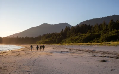
This picture was taken within ƛaakašiis—pronounced Tlaa-ka-shiis—located within Tla-o-qui-aht Tribal Parks. There is no concept of the word "wilderness" in the Nuu-chah-nulth language. The closest term, "walyuu", translates to "home". What may appear as untamed or "wild" landscapes to outsiders are, in fact, territories that have been carefully managed and nurtured by Nuu-chah-nulth peoples for millennia.

Article: Why IPCAs Matter

Article on Indigenous Protected & Conserved Areas

Glossary

Aboriginal law refers to an area of law under the Canadian legal framework, which is reflective of Canada’s colonial history as it relates to Indigenous peoples, including the Royal Proclamation of 1763 and the Indian Act.

Aboriginal Title is a legal interest in land held collectively by an Indigenous people. It includes the right to decide how the land will be used and the right to benefit from those uses.

Aboriginal rights are substantive, legal rights related to the practices and traditions that form an integral part of the way of life of an Indigenous people.

Since 2019, BCMT has committed to seek partnership with each of the 74 Coastal First Nations for Free Prior and Informed Consent on anything BCMT shows or does on their Territory. To date we have partnered with over half of nations, with new engagements sought year round with the help of the First Nations Liaison and the First Nations Engagement Committee.

First Nations are 1 of 3 recognized Indigenous Peoples in Canada, along with Inuit and Métis. There are 74 First Nations on the coast of British Columbia, 45 of which are on Vancouver Island alone.

The geographic area identified by a First Nation as the land they and/or their ancestors traditionally occupied and used for which Canada and British Columbia recognizes their Rights and Title.

“The Declaration on the Rights of Indigenous Peoples requires States to consult and cooperate in good faith with the indigenous peoples concerned through their own representative institutions in order to obtain their free, prior and informed consent before adopting and implementing legislative or administrative measures that may affect them (article 19).” – Free, Prior and Informed Consent of Indigenous Peoples

First Nations in BC are leading the way in stewarding their Territories through a variety of Guardian and stewardship programs, these programs and staff are continuing the work First Nations have undertaken in their Territories since time immemorial. Guardians are an extension of First Nations self-determination, serving as their Nation’s “boots on the ground” and providing cultural expertise and stewardship, monitoring, public safety, education and knowledge exchange. “Guardians” is an umbrella term used to refer to a variety of programs led by First Nations, including, but not limited to: Liaisons, Watchmen, Rangers, Stewards, Nation Patrol, Territorial Patrol, Field Technicians, and Environmental Monitors.

Guardians are on-the-Territory and on-water stewards who are highly trained. Follow any instructions they may give you and feel free to ask them questions. Some areas are also covered by the Coastal Nations Coast Guard Auxiliary

Lands held by the Government of Canada, for the exclusive use and benefit of a specific First Nation. These lands are legally designated for the community and should be considered private. Access or use of these lands requires permission from the respective First Nation.

The laws and legal systems of Indigenous Nations, which exist separate and apart from the Canadian legal system except to the extent they’ve been incorporated into Canadian law.

Indigenous Protected and Conserved Areas (IPCAs) are lands and waters where Indigenous Peoples have the primary role in protecting and conserving ecosystems through Indigenous laws, governance and knowledge systems. IPCAs include a spectrum of conservation mechanisms and models that support Indigenous leadership in conservation. Areas conserved by Indigenous Peoples, such as IPCAs, are only one part of Indigenous-led conservation efforts taking place across Canada.

Aboriginal Rights and Title refer to the rights of Indigenous peoples in Canada to their traditional lands. The courts in Canada and British Columbia have recognized these rights, which are based on the long-standing use and occupancy of the land by First Nations.

In British Columbia, there are 74 Coastal First Nations, each with their own Territories along the coast. However, Aboriginal Rights and Title do not necessarily exist on all the land, depending on extent of use and other factors. Aboriginal Title most likely exists in village sites, cultural sites and harvesting areas used by the First Nations for millennia. Many of these sites overlap with where recreationists visit.

Recently, the government of British Columbia has been working with some First Nations to create agreements that acknowledge their Rights and Title, and to develop processes for jointly managing land and resources. It’s important to note that these agreements do not include private lands, which are those registered under the Land Titles Act in BC.

Agreements defining Right and Title in individual First Nations’ Territories may, over time, lead to changes in public land use — by ensuring our recreational community visits First Nations Territories respectfully, we build a stronger voice for advocacy and long term productive engagement.

Treaty rights are established legal rights set out in formal agreements between the Crown and Indigenous peoples and protected by the Canadian Constitution.

First Nations Territory is a self declared area to which a First Nation’s inherent Rights and Title may exist and to which there is inherent management.

Treaty Settlement Lands (TSL) include lands transferred to First Nations as a result of modern treaty efforts and Indian Reserves may be included.  TSLs can be declared “public” or “private”.  Assume that it is private unless there is information to the contrary.  Access or use TSLs only by permission from the First Nation.

The Truth and Reconciliation Commission of Canada was organized by the parties to the Indian Residential Schools Settlement Agreement. The commission was part of a holistic and comprehensive response to the charges of abuse and other ill effects for First Nations children that resulted from the Indian residential school legacy. The Commission was officially established on June 2, 2008, and was completed in December 2015.

UNDRIP received Royal Assent on June 21, 2021 and immediately came into force. This legislation advances the implementation of the Declaration as a key step in renewing the Government of Canada’s relationship with Indigenous peoples.The provincial government passed the Declaration on the Rights of Indigenous Peoples Act (Declaration Act) into law in November 2019.

Donate to our First Nations Engagement Program

As a non-profit, we rely on membership fees and donations to fund our important work.
Donate