Jon Dawkins tackles the open outer shores of Hakai.
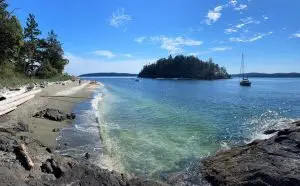
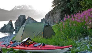
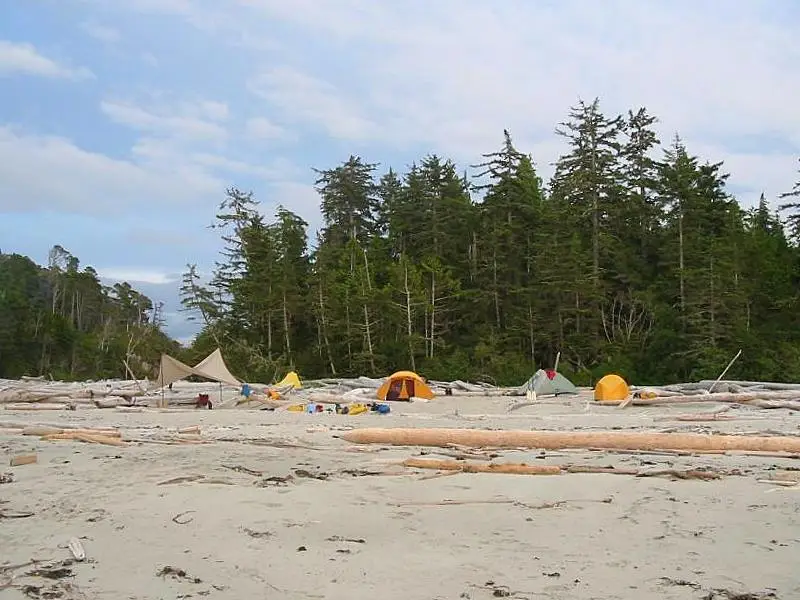
I left Blackney Beach while the NW wind was at 10 knots with the knowledge that it would build. The forecast called for moderate seas with NW winds at 15 – 20 knots, a westerly swell to 2 meter with wind waves to 3 feet. I wanted to make as many miles as possible before it gained in strength. The bad news was that it built more quickly than I anticipated. The good news was that it was mostly at my back. Shortly after leaving the beach Herbert Point gained my full attention and was a harbinger of what south Calvert’s finest features had to offer. Progress became a “Game of Points” with each point contested and earned. By the time I rounded Stafford Point I was a bit battle weary and ready for something else. With no particular plan I tucked into the lee of Stafford and mindlessly toured calm Chic Chic Bay. That was a bit of a trap, though, as the deeper I went into the bay the more I was committing to paddling cross-conditions to get back out. Coming to my senses I looked ahead, got back on track and gained Charley and then O’Neil Islands. Both were real pleasures to meet and gave me a taste of what they could produce if they seriously had a mind to be contentious. Like a couple of rough drunks in their home bar they needed to be studied and navigated with caution. After developing a stiff neck from watching conditions over my right shoulder and applying well practiced braces I approached the passage between Sorrow Island and Cape Calvert. Grief Bay was still out of sight on the left and current running out of the passage was stacking waves and creating a line of white water. My GPS indicated that a shoal was responsible for the unpleasantness on the left and that I should be able to slide though deeper water mid-channel. I hurried through it and retreated to a kelp bed just inside the weirdness for a well-deserved mental and physical rest. After some relaxation and refueling I paddled on in to “tropical” Grief Bay. It was obvious why Kayak Bill had chosen this isolated setting for a camp site. I landed on the lovely sand beach and set up my tent near the stream. Walking along the beach I didn’t favor my chances of finding his camp yet there it was, just inside the forest with the wind block still intact. It was very easy to see. The firewood rack was still in place and 1/2 full of wood perfectly cut to Bill’s dimensions. Moss and Salal had taken over the camp so any of his usual personal possessions now belonged to the forest. I was surprised to learn that the flood current ran north along the entire outside of Calvert. It seemed to me that it would be easier for the flood this far south to run into Fitz Hugh Sound, Rivers Inlet or turn north near Herbert Point. I guess that means that paddling this shoreline from north to south on a high pressure day is more comfortable on an ebb. As I relaxed on my warm sheltered beach I reflected on how I had paddled for the past three days in green water up to my elbows and been schooled by current, winds and topography. Once again I had found the Hakai Luxvbalis / Calvert Island paddling experience to be beyond comparison. I highly recommend it. Blackney Beach to Grief Bay is 11.2 nautical miles.