My husband Eric and I completed a nine-day kayak trip in the Nuchatlitz Group in August 2023, and we had a favourite day on this trip. After weathering strong and gale-force winds and three to four metre swells for the first few days, finally a break in the weather allowed a crossing of the Nuchatlitz Inlet for a day of exploration. The forecast on the VHF radio for this day trip was low wind and swell for West Coast Vancouver Island South, so it was time for extended touring from our base camp.
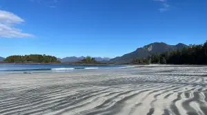
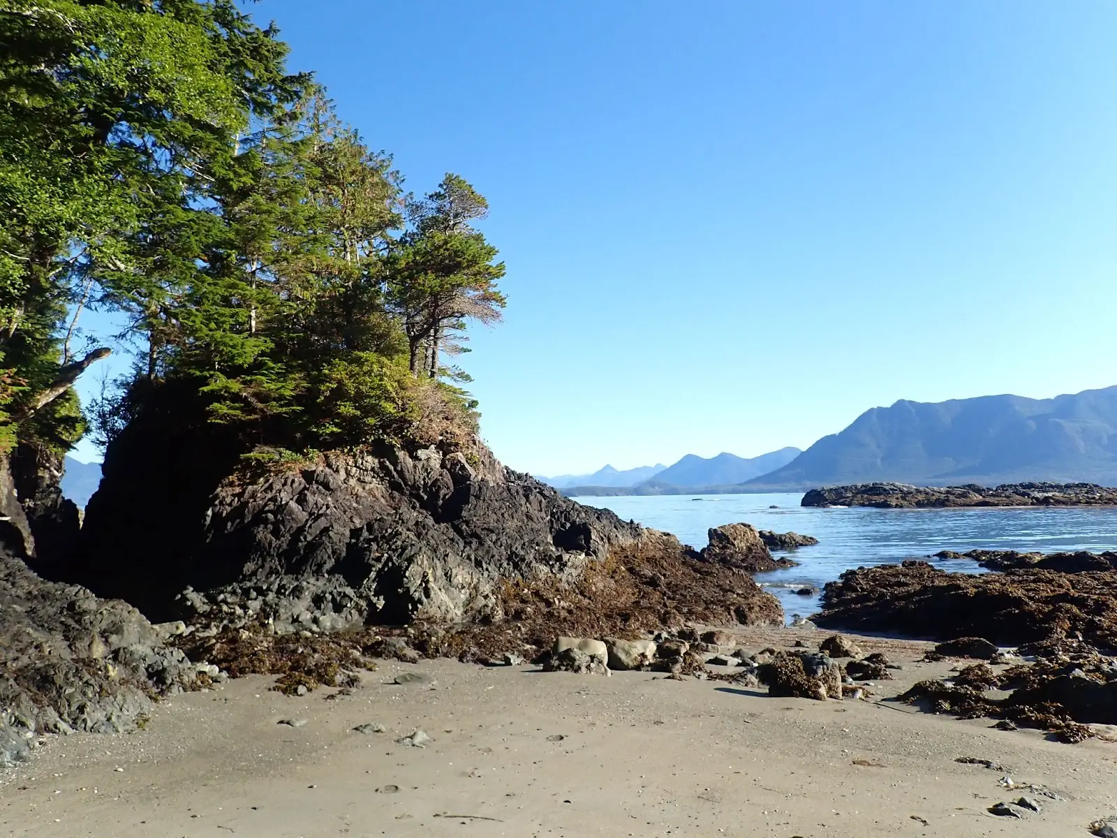
What made this a favourite day was the sheer beauty of the rugged, wild coast every second of the day, combined with superb weather to make it a relaxing and enjoyable paddle. It was the kind of paddling day that you just want to go on forever. Every inch of this coastline was filled with arches, caves, sea stacks, and pocket beaches; meanwhile, we were surrounded by the gorgeous mountains, sunny blue skies, beautiful kelp, sea otters, sand beaches, and total remoteness (not seeing another person), which made it a day to remember. The dream day was capped with a spectacular sunset from our campsite.

The day trip plan involved an initial five-km crossing of Nuchatlitz Inlet to Tongue Point on Nootka Island, contouring the Nootka Island coast eastward to Hixson Bluff, crossing the inlet again to Benson Point, and then contouring the coast back to our base camp.
For navigating the day, we were prepared on several fronts. We calculated distances for the total route (shy of 30 km), distances between various key segments such as between points or bluffs, and the length of crossings. We also measured bearings to land at the Tongue Point campsite in a straight shot across the Nuchatlitz Inlet and across the inlet from Hixson Bluff to Benson Point. To navigate across Nuchatlitz Inlet and land at Tongue Point, we used a peak on Nootka Island as the distant fixed object. Outside of the crossings, our route involved handrailing. Eric and I each had a chart and a compass. There was no fog in the forecast for the day, although we were prepared to navigate in fog. We had everything we needed to successfully navigate our day of touring.
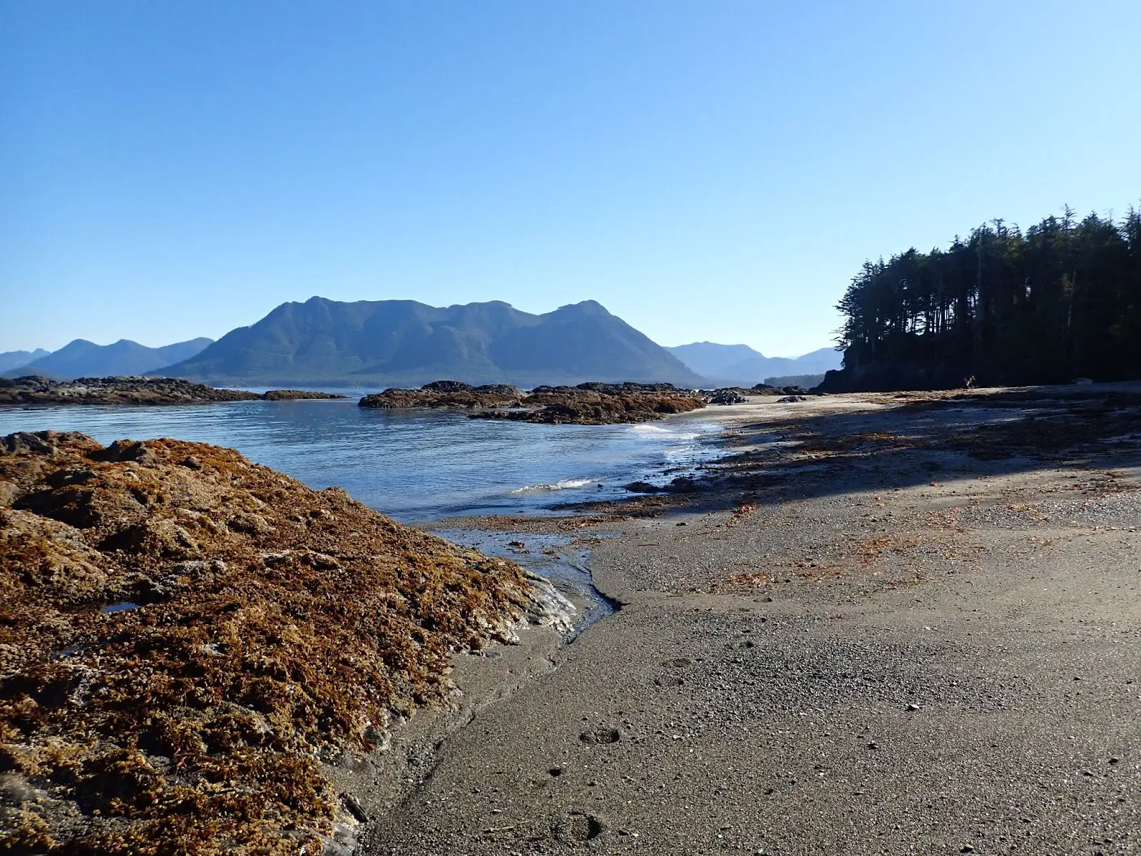
We set off before 8:00 a.m. for a calm, sunny crossing to Tongue Point where we explored the campsite for potential future trips to the region. We then contoured the coast of Nootka Island eastward, with Louie Bay being the first notable landmark. Float planes glided over us to drop off hikers for the Nootka Trailhead. It was a low tide so we ventured only into the entrance of Louie Bay lagoon, where we were surprised to see massive chunks of a shipwreck along the very protected lagoon shoreline (“How does a ship get wrecked here?” one asks oneself). “Did you know that you can visit the remains of a shipwreck at Louie Bay? On December 7, 1969 the 16,000-ton Greek freighter Treis Lerarchi ran aground and sank off of Ferrer Point on Nootka Island. All 28 crew members were rescued. Scrap metal salvagers looking to make money towed the wreck to Louie Bay where the ship was blown up to more easily retrieve the pieces. Abandoned pieces may still be seen at Louie Bay.“ ¹ A favourite segment was between the Tongue Point campsite and Florence Point, as the rock formations were most spectacular.

Crossing to Benson Point, we explored the campsite there but our main purpose was to find the location of the water source. We understood from the BCMT map that a freshwater stream was located at the point, and we planned to return here in a couple of days for water resupply. The sandy beach at Benson Point was staggeringly gorgeous! We enjoyed our lunch there before continuing back to base camp.

We continued along the shoreline and entered the Nuchatlitz Group with smiles after such a satisfactory paddle day. The day ended with a most exquisite west coast sunset, viewed from our campsite.

Trip Transportation Notes: The MV Uchuck III kayak wet launch service was used for transportation. We drove to Gold River with our kayaks and gear and dropped off loaded kayaks at the Get West Adventure Uchuck terminal the day before the cruise. The Uchuck provided kayak transportation to and from Rosa Island in the Nuchatlitz Group. That made it easy to do this trip to a remote stretch of Vancouver Island coast, by avoiding a long paddle to get to the destination. At Rosa Island, we were wet launched one by one, by the winch crane. What an incredibly unique experience to be slowly dropped into the water while sitting in your fully loaded kayak, and then paddle off on an adventure! For more details on using water taxis to access new kayaking destinations, see Jerry and Julee Kaye’s new article, Water Taxis: A Great Way to Access 10 New Paddling (and Hiking) Adventures on the BC Coast.
Trip Planning: Primary resources for planning this adventure were
- advice from friends who had experience in the region (favourite campsites and paddles, where to find fresh water),
- the BC Marine Trails map (campsite and water source locations, map tools), and
- the CHS chart for the region (marking campsites, fresh water, and destinations on the chart, to display on the kayak deck).
A plan for three different campsites over the course of eight nights plus paddling day trips (Plan A), and a second modified plan given the inclement weather forecast (Plan B), were created. Other information gathered pre-trip was distances between each segment using BC Marine Trails Trip Planning tool, bearings for crossings using the CHS chart and compass, and tides.
1. Nootka Marine Adventures Facebook page, October 19, 2017.