Haida Adventure
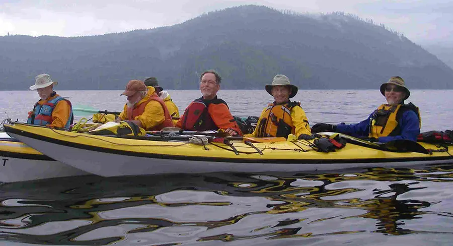
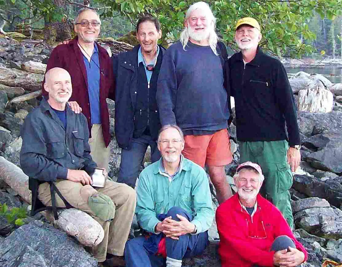
In mid August 2011, Alan Campbell, Robert Dill, Henry Graymen David Maxwell, Ron Painter, Rob Zacharias and I headed up towards Haida Gwaii (formerly known as the Queen Charlotte Islands) for an extended kayak trip. Most of us drove up to Port Hardy at the northern end of Vancouver Island and walked our gear/boats on the ferry to Prince Rupert.
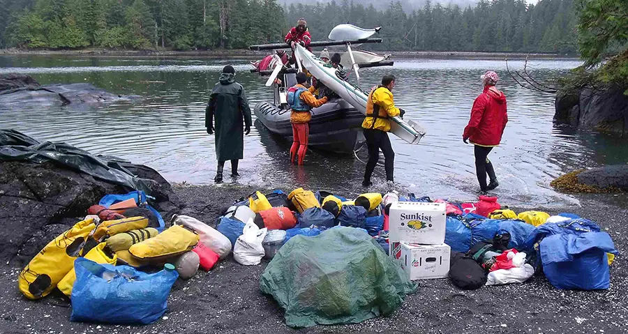
Another ferry took us over to Skidegate on Graham Island where we boarded yet another ferry to get to Alliford Bay, Moresby Island. From there after traveling down a logging road and a rough windy, cold and wet ride in an open Zodiac, our boats, gear and bodies were dropped off on Ross Island close to southern end of Haida Gwaii in the Gwaii Haanas National Park Reserve. It had taken us four days just to get this far and we hadn’t started to paddle.
Haida Gwaii (“Islands of the People”) is an archipelago on BC’s north coast. Haida Gwaii consists of two main islands: Graham Island in the north, and Moresby Island in the south, along with approximately 150 smaller islands with a total landmass of 10,180 km2 (3,931 sq mi).
The islands are separated from the BC mainland, to the east by Hecate Strait, Vancouver Island to the south and Alaska to the north. The marine border, Dixon Entrance, is disputed by Canada and the USA. Haida territories, continuously occupied before Canadian or USA claims, include lands and waters on both side of this political disagreement. There is no evidence of a free informed prior legal transfer of these territories from the Haida Peoples to either country.
13000 Years Ago
During the end of the last ice age between 13,000 and 11,000 years ago, Hecate Strait, was for the most part dry land. There were lakes and small rivers draining north and south to the Pacific Ocean in that area. Soil samples from Hecate Strait indicate that many areas were habitable in the last ice age. 10,000 years ago, the melting glaciers contributed to a rise in the sea level that resulted in a gradual flooding of Hecate Strait and the northwest coast, creating beach lines above today’s high tide marks.
Archaeological Research
Archeological research identifies Haida Gwaii Aboriginal artifacts that predate 8,000 B.C. It is possible that remnants of the dry plain to the mainland may have still existed at that time as Haida oral history contains stories with matching physical descriptions. Haida traditional territory encompassed Haida Gwaii and a portion of the Alexander Archipelago in the Alaska panhandle.
The Haida tell of a primordial time where no divisions existed between humans, animals and spirits. It was an age when all realms of existence were interconnected and all beings could pass freely between them. A significant event in mythical time occurred when Raven released the first humans from a clamshell in which they were hiding. Since that time the Haida have divided themselves between two families: Ravens and Eagles. Ownership of their family crests, territories, stories and dances have been passed down for centuries through birth and marriage.
Archaeological surveys have located sites in all parts of Haida Gwaii that indicate the population was sizable by 5,000 years ago. At about that time, their economy was expanding from a primary reliance on hunting and fishing to include harvesting shellfish from the huge intertidal areas that surround many of the more protected waterways of the islands.
The abundance of shellfish provided a virtually inexhaustible supply of food. It also made possible a stability of residence that allowed the establishment of more permanent villages where food, tools and other material objects could be safely stored, as well as the development of craftsmen who could devote more time to art. These changes led to the refinement of woodworking tools and skills, which, in turn, allowed for the construction of bigger and more elaborate canoes as well as larger plank longhouses.
This indicated the beginning of a trading pattern among the Haida and the neighbouring Tsimshian and Tlingit that led to increased sharing of symbols of wealth and materials of exchange, and eventually to closely parallel art styles that were different from those of groups to the south.
Haida Canoes
The Haida canoes were the main means of transporting goods and people up and down the coast although their shape and size varied; the 16.5-metre canoe could take 5 tonnes of cargo and needed a crew of 10 paddlers and a steersman. It was equipped with three masts and sails that helped increase its speed when the wind was blowing. It was made from a single, large red-cedar log that was skillfully dug out, steamed, shaped, carved and painted to produce an elegant, efficient, seaworthy craft.
Permanent Haida villages consisted of one or more rows of houses strung along a beach. Double-row villages were quite common. Their houses were exceptionally well constructed with multiple cedar roof beams projecting several feet beyond the front and rear cedar facades. The centre or ridge beam was broken in the middle for the smoke hole. It was the custom of erecting the carved column in contact with the front of the house and cutting a circular doorway through both. The better houses boasted a centrally excavated pit, often terraced with several tiers leading into the base of pit where a house fire burned which served for cooking, drying and heating.
Living and sleeping places were apportioned according to rank with the chief in the upper tier in the back of the house and the slaves on the floor in the pit. Longhouses held 50+ people.
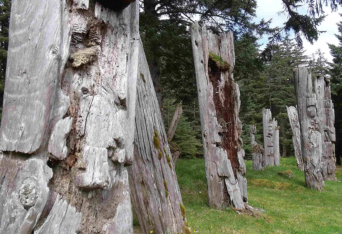
Memorial, mortuary, inside and frontal are the 4 types of poles carved by the Haida. When a chief died, his body was stored inside a bentwood mortuary box until a mortuary pole was complete. Memorial poles were erected in memory of a deceased person whose remains were missing or lost at sea. Frontal house poles tells the family’s story and served as the house entrance. The interior of a chief’s house often contained a pole, 9-10 ft high, which depicted one of their crest figures. The village or house chief sat and slept in the front of this pole.
The division of labor was along sex and to some extent class lines. Women gathered roots, berries and seaweed for food and,cedar bark and spruce root for weaving. They processed and preserved all food items, prepared animal skins and made all clothing and basketry. Men fished, hunted sea and land mammals, constructed houses and canoes, and undertook carving and painting. Lineages controlled both real and incorporeal property including fishing and trappings sites. All winter villages were comprised of house owners of both eagle and raven lineages.
The Haida were feared along the coast because of their practice of making lightning raids against which their enemies had little time to mount a defense. The Haida frequently raided each other’s villages in Haida Gwaii as well. Their great skills of seamanship, their superior craft and their relative protection from retaliation in their island fortress added to the aggressive posture of the Haida towards neighbouring tribes.
The Haida went to war to acquire objects of wealth, such as coppers and Chilkat blankets, but primarily for slaves, who enhanced their productivity or were traded to other tribes. Captives were also the source of ransom such as crest designs, dances and songs. Pre-contact, there were approximately 15,000 Haida.
The archipelago was visited in 1774 by Juan Pérez (at Langara Island) and in 1778 by Captain James Cook. The village name Masset is also the result of earlier contacts and assistance given to Spanish ships perhaps as early as the 16th century. In 1787 the islands were surveyed by Captain Dixon. The islands were named after King George’s wife, Queen Charlotte (also the name of one of his ships) by Captain Dixon. The trading prize were Sea Otter pelts, which made ship owners very wealthy, however the animals were eventually hunted to extinction.
During the first visit of the American trading vessel Lady Washington to the coastal waters off the Queen Charlotte Islands, in June 1789, it encountered the Kunghit Haida residents of Ninstints. Amicable trade resulted. When the ship returned under a different captain, John Kendrick, pilfering of minor items from the ship led to an excessive response from Kendrick, who seized two village chiefs as hostages.
Captain Kendrick returned in 1791, allowed natives to aboard and without warning, his armed officers and crew killed forty to fifty Haida. In return the Haida attacked other trading ships until relations improved.
The Sea Otter trade died out by 1830 but Hudson Bay Company established a trading post in exchange for land fur, dried halibut and herring. The Haida continued to travel; in 1853 five hundred canoed south to the colonial outpost of Victoria. Their arrival frightened the small settlement and Governor Douglas sent them home.
A smaller flotilla of five canoes quietly returned to Victoria. Trading in 1862 brought a devastating smallpox epidemic that severely reduced the population to a low of 600 by early 1900s. Entire villages were abandoned, most survivors relocated to Masset or Skidegate. Over the years their numbers have increased and today there are some 3,800 Haida citizens living on the islands.
At Athlii Gwaii (Lyell Island) in 1985, Haida elders were arrested for blocking a logging road. After 10 years of land-use planning, negotiations and court cases, the Haida drew a line. Support from across North America helped make this a successful protest, as over 150 organizations were active in the campaign. The Canadian, B.C. Govt’s and Haida Nation created what is today the 1,495 square-kilometer Gwaii Haanas National Park Reserve, Marine Conservation Area Reserve and Haida Heritage Site. This area is protected and co-managed by the Federal Govt and Haida Nation.
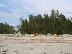
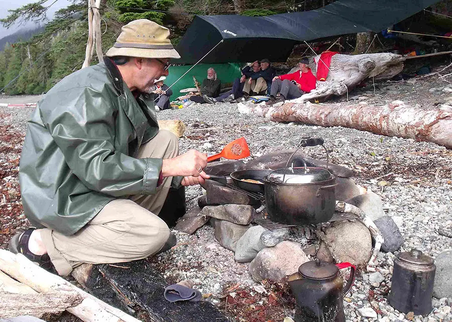
We set up our 1st camp on Ross Island, near the southern end of Gwaii Haanas, in the rain. We came prepared for extended periods of rain by bringing two large kitchen tarps plus additional tent tarps to keep gear dry when setting up or taking down camp.
SGang Gwaay “Red Cod Island Village” was on Anthony Island. It was also known as “Ninstints”, the name of the most powerful of the village’s chiefs in the mid-19th century. This type of designation came to be used by ship captains to refer to villages by the name of the headman at that location.
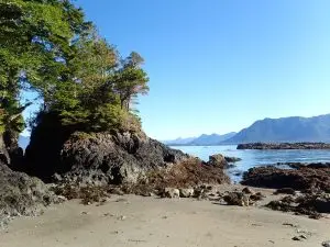
The island is small and exposed to the sweep of the open Pacific. However, the village is the most secluded of all sites, as it is located in a sheltered bay on the east side and further protected by an islet facing the village.
The Haida people recognize that natural and cultural elements cannot be separated, and that the protection of old village sites is essential to sustaining Haida culture. They initiated the Watchmen Program to protect these and other important locations.
SGang Gwaay was declared a UNESCO World Heritage Site in 1981. The Haida are attempting to repatriate some of the removed poles and other heritage objects. There were 17-20 longhouses on site; today human occupation is evident in the form of habitation caves, middens, upright/fallen poles, house pits and posts/beams from the longhouses.
When approaching one of the old village sites, we used our VHF radios to ask permission to land. The Watchman allow small groups to tour the sites and provide an excellent interpretive program to all who come ashore. Historically the Watchman kept lookout for raiding parties and were honored as the top pole figures, wearing high hats.
After 4 nights on Ross Island we packed up the boats and in sunny weather headed down Houston-Stewart Channel, round Benjamin Point and across Carpenter Bay to Samuel Rock where we set up our 2nd camp.
The next morning, after a lazy pancake breakfast, we listened to the Marine Weather forecast of approaching rain and winds +35kms. As we had an exposed crossing to make and didn’t want to get stuck in this location for a number of days, we broke camp. With the winds at our back and paddling with the current, we rounded Ikeda Point. Crossing Skincuttle Inlet in rough seas and strong winds made for a strenuous paddle.
We set up our 3rd camp on one of the small Swan Islands. The rain and wind howled thru the Sitka Spruce trees that night. The next day we received a visit from the staff of the Discovery Youth Camp located near us. A few of the guys paddled over to repay their visit and assisted with loading the teens on to a Zodiac which had come to transport them back to Moresby Camp.
The Discovery folks gave us a large piece of Halibut, which was added to our dinner. After hearing the weather report the next morning we packed up, in the rain, and paddled thru Dolomite Narrows and Burnaby Strait which is well known for its aquatic shallow marine life. While paddling into the narrows, we spoke with a solo kayaker whose boat was so over loaded with excessive gear that, in rough seas, they were putting themselves at risk.
We had showers and heavy mist all day but our route was mostly in protected waters. Our 4th camp was at Newberry Cove. It had been raining for a number of days, we were a soggy and damp bunch of smelly guys. This site had a great fresh water stream, which we all bathed in plus washed some well needed laundry. After chili for dinner, it was an early nite for us.
It was rainy and windy most of the next day as we paddled across Juan Perez Sound and set up our 5th camp on Murchison Island. Hotspring Island (Gandll K’in Gwaay.yaay) was just next-door. The hot spring waters flow from a number of faults and fissures and are funneled into a series of cascading pools. Water temperatures range from 32 to 77 Celsius (89 to 170 F).
Like other sites, the Watchman regulates the number of guests, as this is the most visited site in the islands. We woke the next morning to sunshine and paddled over to the Hotsprings where we spent as much time as possible in the pools.
Our plan was to spend a couple of days here, but again a forecast of approaching bad weather forced us to change our plans and leave the next day. Sadly, Rob and Henry were to be picked up by Moresby Explorers the following day (heading home). The next morning we paddled over again for a final dip in the hot springs and parted ways.
Windy Bay was our destination and as much of the trip would be in open waters, we left in a weather window. Windy Bay (Hik’yah GaawGa) is where many of the protestors on Lyell Island in 1985 gathered to halt logging at Sedgwick Bay. A Longhouse was built that kayakers use today.
The Watchmen gave us a large chunk from the Halibut he had just caught. He also took us on a trail that winds through old-growth western hemlock, red cedar and an 8-900 year old Sitka Spruce.
We left the following morning, paddling up the east side of Lyell Island and found an enormous U-shaped sea cave carved into the rock by years of pounding waves. We rounded Dodge Point in flat calm seas, which was a treat as these waters can be very chaotic and confused as the result of opposing tidal currents and winds. Our 7th camp was on Kunga Island across from the village of Tanu.
Tanu is situated on a sizable island in Laskeek Bay. The name T’anu’ refers to a type of sea grass which commonly grows in shallow water around the village. Its people were very fond of sea bathing, so others would tease them—hence the name. It was also called Klue’s Village after the original town chief. Emily Carr came here to paint in 1907. In the mid-1800s the village had about 550 inhabitants along with more than 25 longhouses, 31 mortuary columns and 15 mortuary houses. There is not much left today except longhouse beams and poles on the ground covered in thick moss.
From there we paddled north across Laskeek Bay to Talunkwan Island for lunch. It took us 1 ½ hours to paddle ½ the distance from there to Vertical Point and 45 minutes for the 2nd half. With tides this time of year running around 24ft, having the tidal current behind you makes a major difference. Our 8th camp was at the mouth of a large creek in Skedans Bay.
Skedans village is located on the neck of a peninsula of land at the head of Cumshewa Inlet. A high rocky prominence at the end of the peninsula offered a perfect site for a fort to protect the village. Skedans is a European rendering of the name of the town chief, Gida’nsta. The Haida name for this town is Koona, or in the old days Huadji-lanas, which means Grizzly Bear Town. Not much is left.
When we approached the village by kayak, we were asked via VHF to wait to land while they finished a ceremony. A helicopter had brought ancient remains and they were blessing them.
The next morning we paddled up the east side of Louise Island and into Cumshewa Inlet. It was a long slug against the wind and current to reach Mathers Creek. Reverend Crosby built a contemporary church settlement in 1887 at the former native village site (New Clue) and erected a dogfish oil extracting plant. During WWII Sitka Spruce was logged in the area to make lightweight airplanes. Remnants of the abandoned community, including a graveyard were obvious. Our 9th campsite.
The following day we kayaked to Moresby Camp at the end of Cumshewa Inlet and were picked up by van and kayak trailer. We spent the night in a B & B in Sandspit.
The next day we took the ferry with our gear/boats over to Queen Charlotte City. We spent two days exploring Graham Island including Skidegate, Tlell and Masset.
The newly opened Haida Heritage Centre & Museum were well done, especially the tours. We boarded the overnite ferry to Prince Rupert then one for Port Hardy. After a drive down island, we arrived home 23 days after leaving. Incredible journey, but our own comfortable beds never felt so good!
What is Haida Gwaii future? Pre-contact; natives lived abundantly off the land/sea. Resource based logging/fishing are nearly finished. The islands are a world-class destination for the travelers but how many tour operators, gift shops and B & Bs can provide a decent livelihood? Haida Gwaii is at a cross roads, perhaps a new paradigm or way of planning is needed. Only time will tell how successful Haida Gwaii will be.