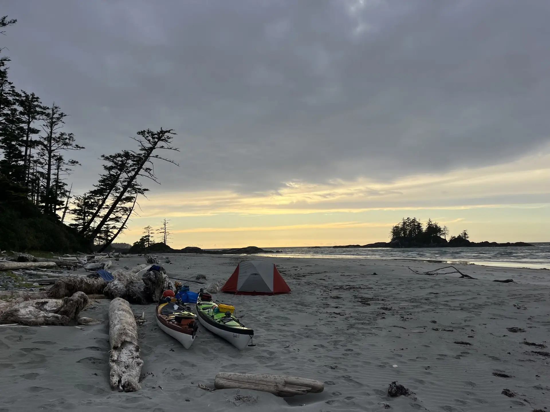
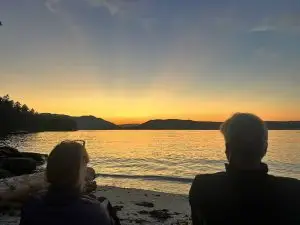
On July 6, 2025, Clara Hudacin and I pushed off a quiet Salt Spring Island beach and took the first of over one million paddle strokes that would take us around Vancouver Island. It was a sunny, calm afternoon. Fifty-eight days later, after paddling 730 nautical miles (1,350 km), our bows scraped up onto that same beach to complete a trip that I had been dreaming of for more than four years. While it’s difficult to fit all the reflections from nearly two months on the water into one article, I’ve included a few highlights, lowlights, and memories here.
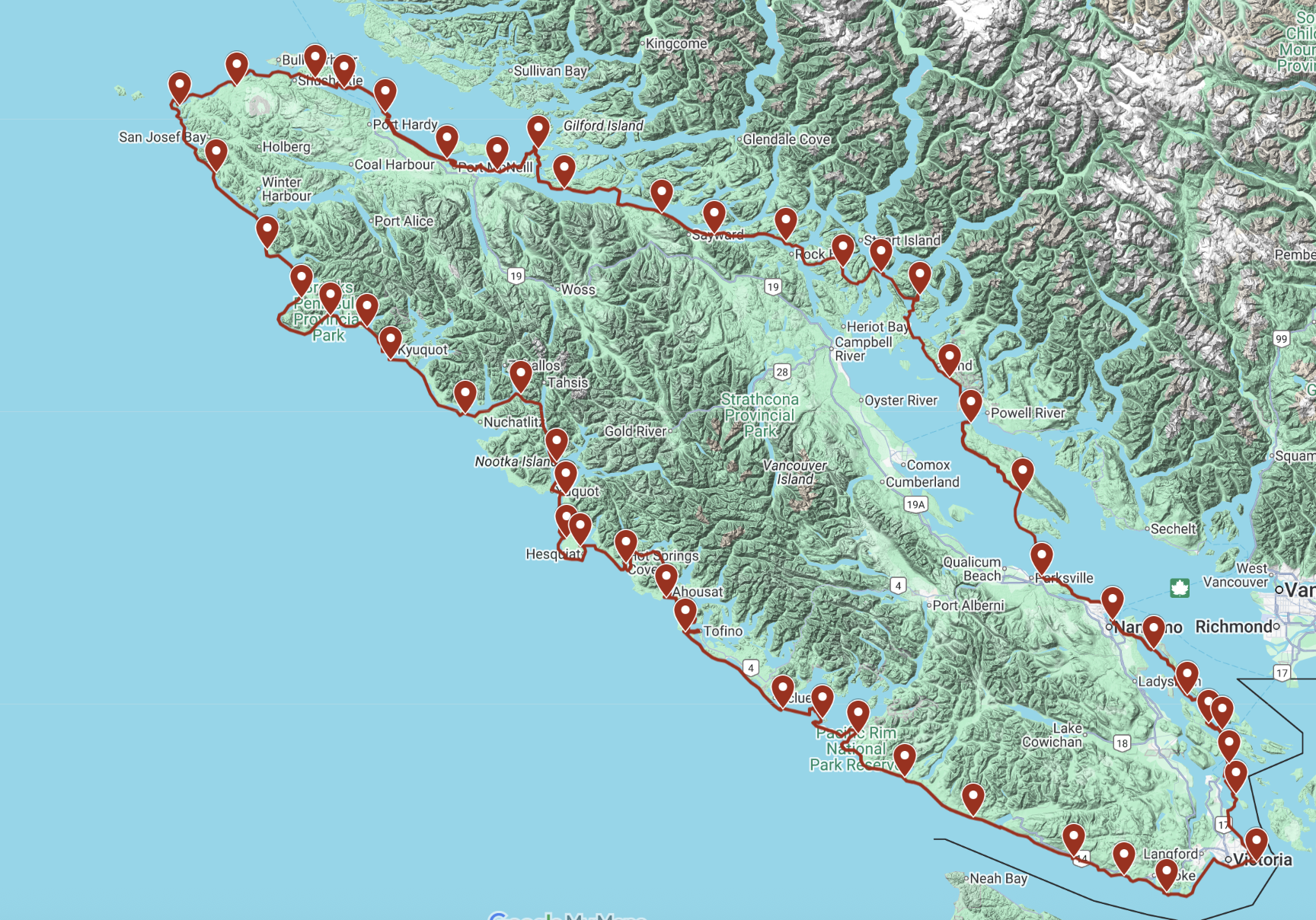
Our route, with a pin at each of our campsites.
Part 1: Salt Spring Island to Texada Island
The first five days of our trip were filled with short paddling days and lots of blissful ocean swims at the beautiful campsites of the Southern Gulf Islands. My mom and Clara’s dad (all the way from Toronto) joined us for five days, giving us a proper send-off. After sharing a campsite with about 80 summer-camp kids, and paddling past the industrial city-scape of Nanaimo, we were glad to head north towards lesser-occupied areas.
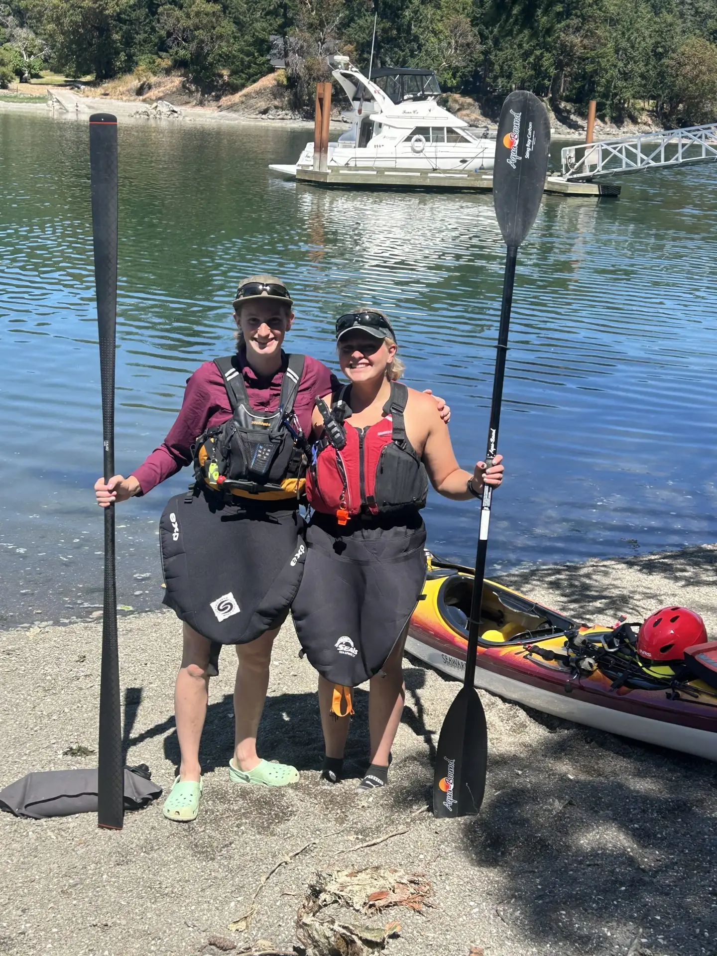
Launch day: Clara (right) and I.
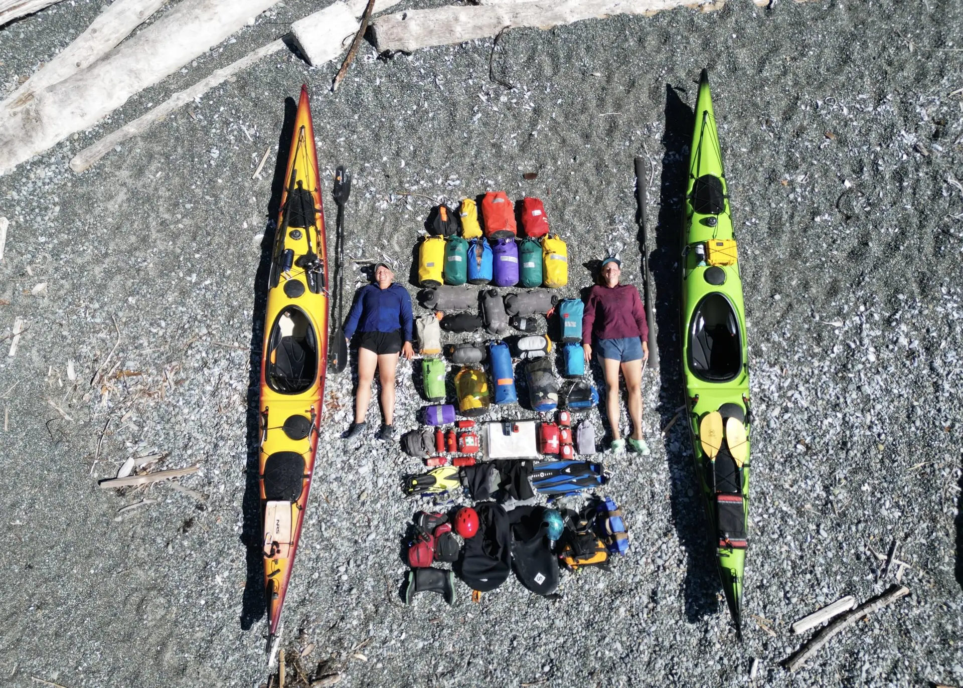
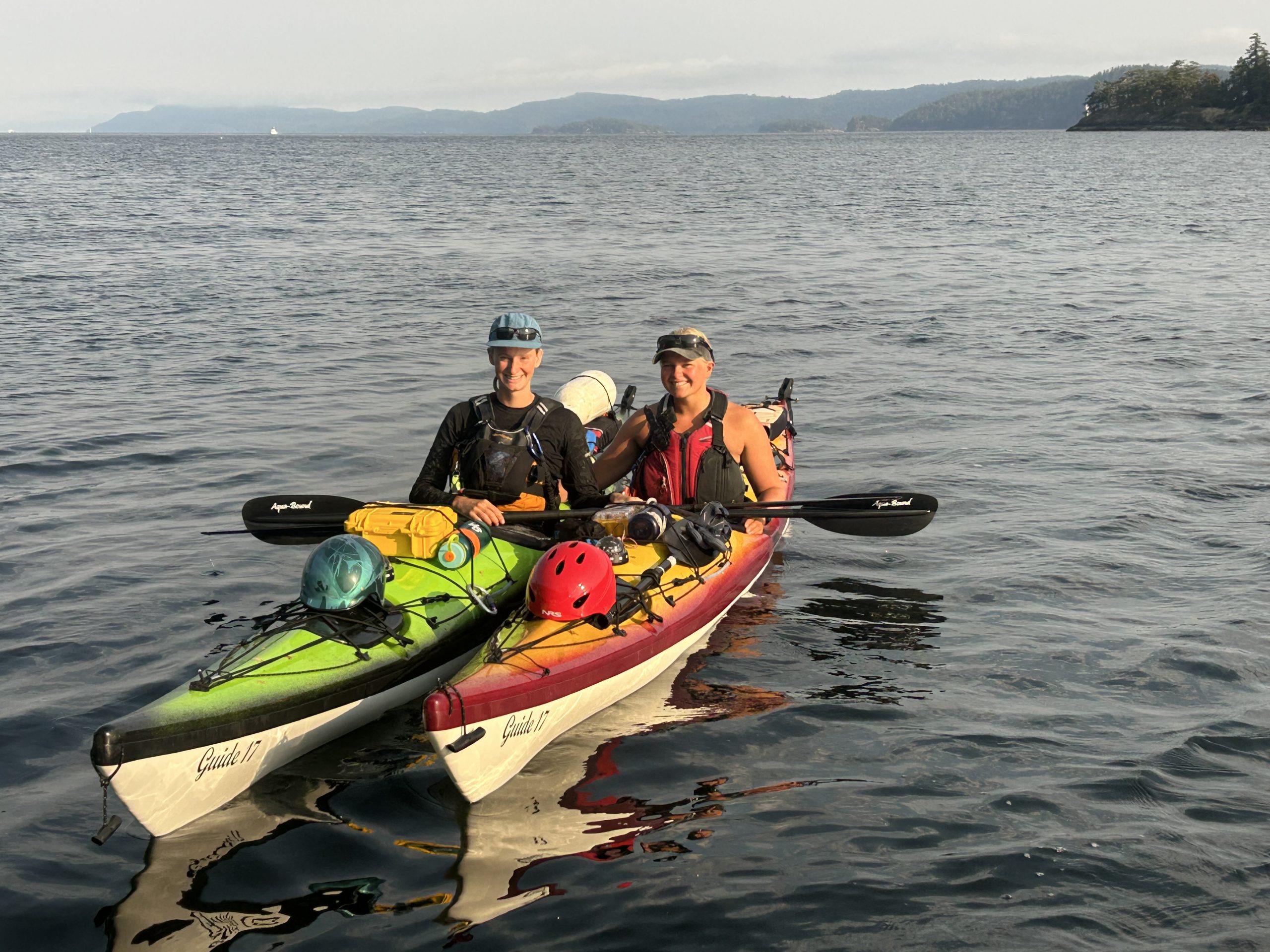
Clara and I with our kayaks (Kermit and Stewie) and all of our gear.
On day five, we said goodbye to our parents in Lantzville and continued onwards to Parksville, the immensity of this trip finally feeling a bit more real. Day six dawned calm and clear; a perfect day to cross the Strait of Georgia. The calm held, but within 20 minutes of arriving at Lasqueti Island, a stiff breeze was whipping up white caps. The next morning, we awoke to a headwind gusting at 15 to 20 knots. This wind would challenge us every day for the next week and a half!
Day eight brought a welcome switch of transportation modes, as we took the ferry from Texada Island to Powell River for the day to buy groceries and a few other supplies. After sitting on the sidewalk outside the grocery store, removing all possible excess packaging from our groceries, we caught a bus, then a ferry, hitchhiked, and walked back to our campsite, loaded with fresh food for the next 12 days. That evening, we took advantage of the heat and jumped into the ocean with our kayaks to practice some rolls and rescues.
Part 2: Texada Island to Port McNeill
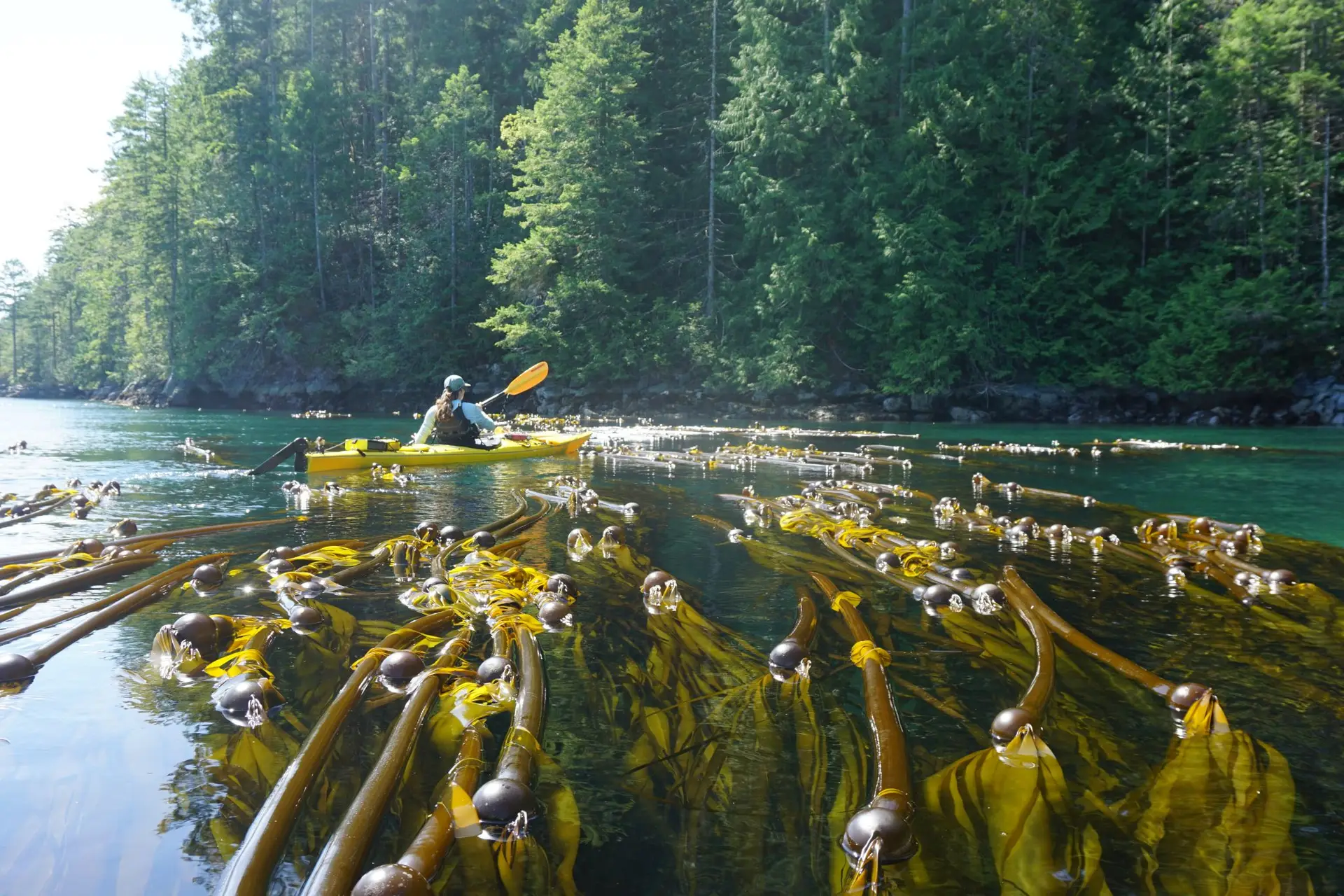
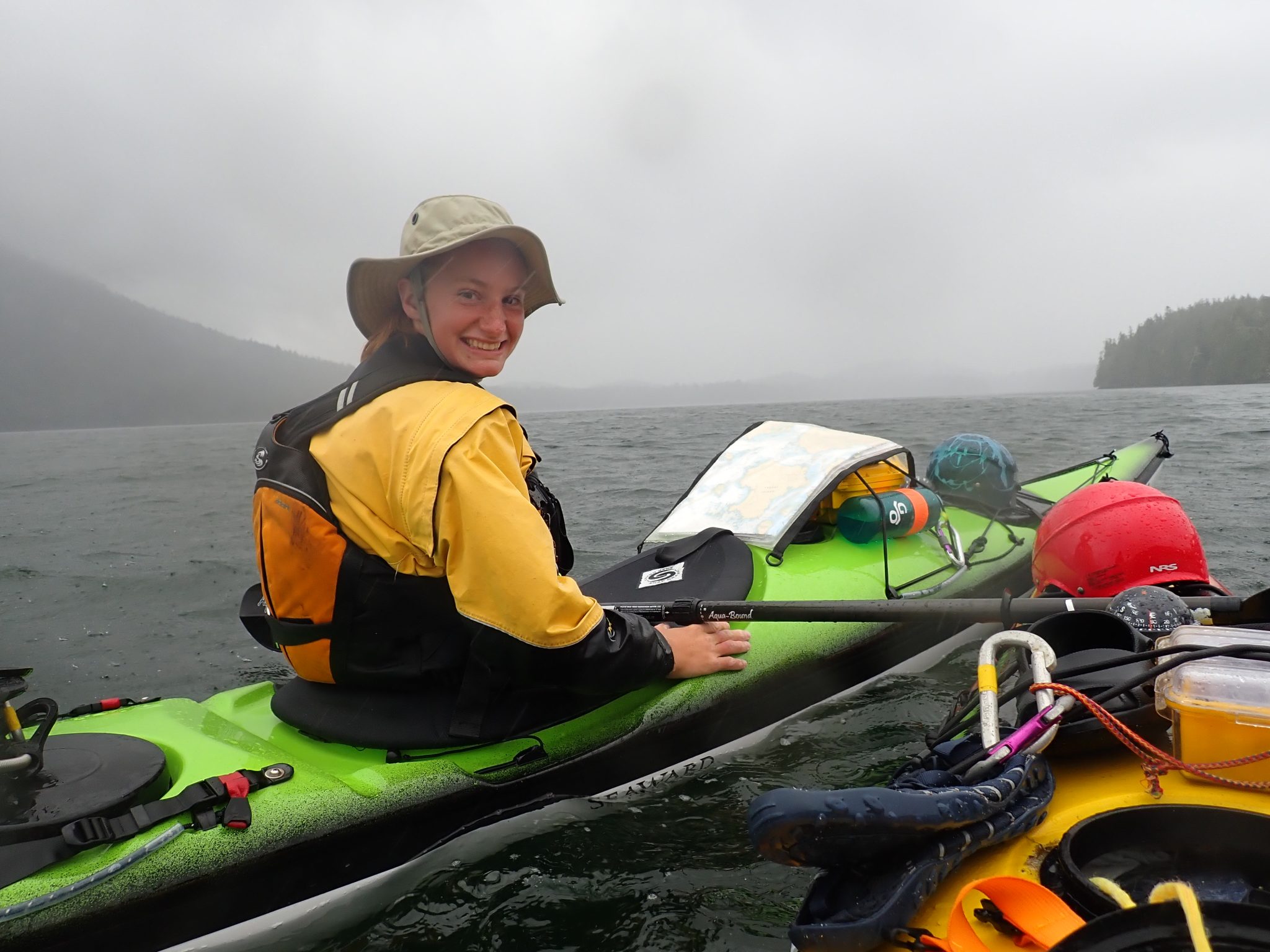
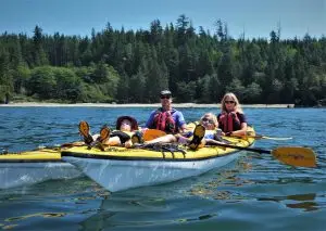
On day nine we awoke to 35-knot winds and crashing white caps, stalling our plans of putting in a big day. Instead, we packed up camp, played cards, cooked dinner early to save time in the evening, and waited. We finally launched around 4 pm as the wind began to die down, and we paddled until 8:15 pm. By 5:30 the next morning we were up, eager to get to Cortes Island, where we met up with our friend Erin who would join us for the next 11 days. After refuelling on some well-earned ice cream and chips, the three of us headed into the Discovery Islands — familiar territory, as I had worked as a kayak guide there a few summers before. Paddling through Desolation Sound and the Discovery Islands was fantastic, with massive kelp forests fanning out below craggy mountains, and porpoises, dolphins, and eagles greeting us every day.
Clara and I paddling through a stunning channel in the Octopus islands.
Our friend Erin navigating a healthy bull kelp forest in Okisollo Channel.
After a lovely few days exploring the Discoveries, we made a well-timed passage through the strong currents of Okisollo narrows and entered Johnstone Strait. While the Strait is known for its abundance of whales, we saw not a single one as we battled strong headwinds and stronger currents for four long days as we inched our way towards the Broughton Archipelago. What we hoped would be our last day in the Strait ended with a soaked, exhausted, and cold 3 pm stop on a steep beach where we reluctantly set up camp, as we finally admitted defeat against the strengthening headwinds. Our log entry from day 15 laments being familiar with every whelk and barnacle in the Johnstone Strait, after hugging the shoreline in a desperate, slow attempt to make headway against the incessant wind.
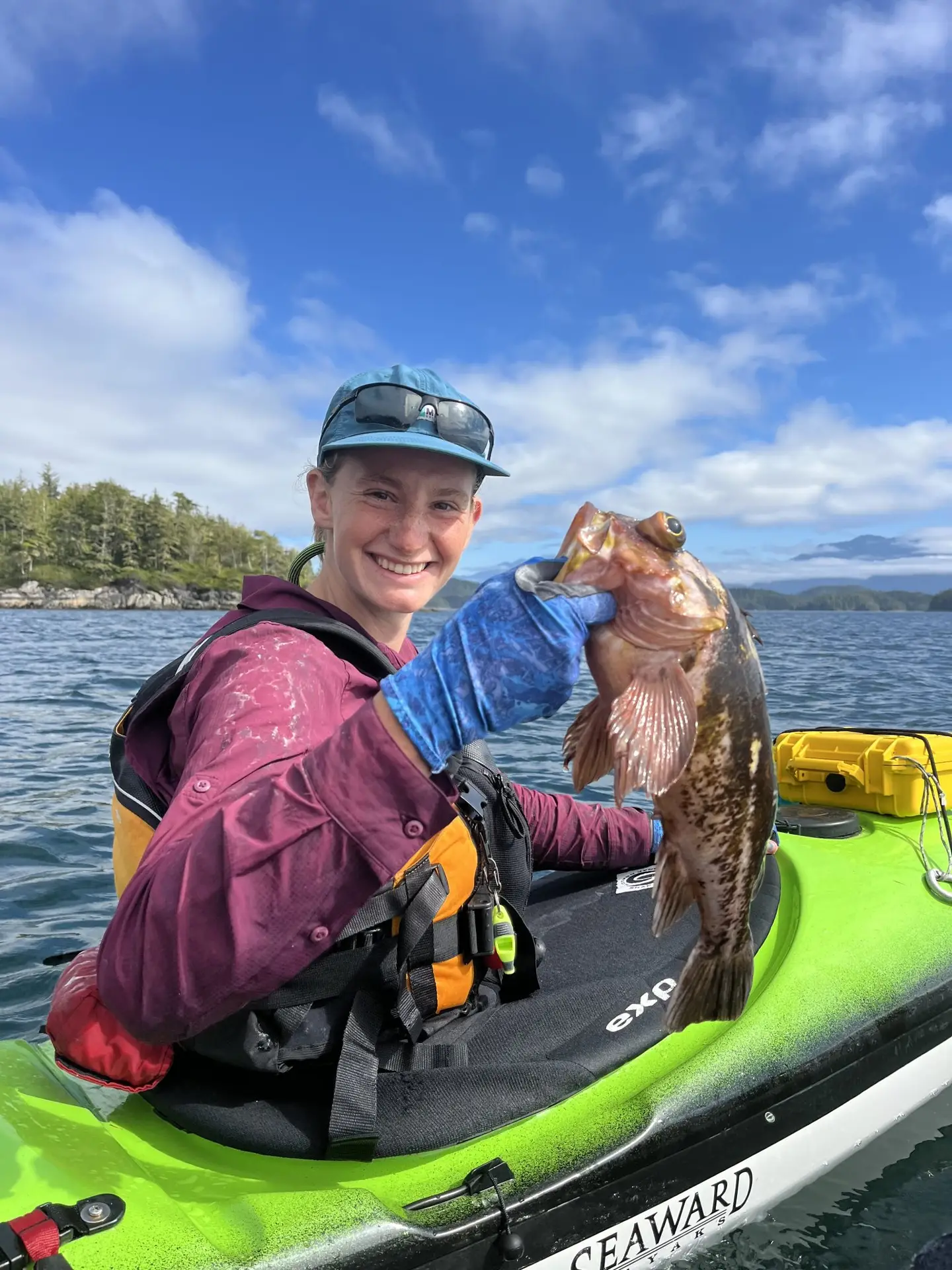
Finally, on day 17 we entered the Broughton Archipelago on a magically calm, foggy morning. We were immediately greeted by the sound of humpback whales breathing all around us. We were elated to see whales breaching and sea lions playing in the strong currents that make these islands so abundant in life. We enjoyed a much-needed rest day in the Broughtons, with a day trip to explore some of the islands (in speedy empty kayaks!), and caught fresh fish for dinner.
My catch of the day.
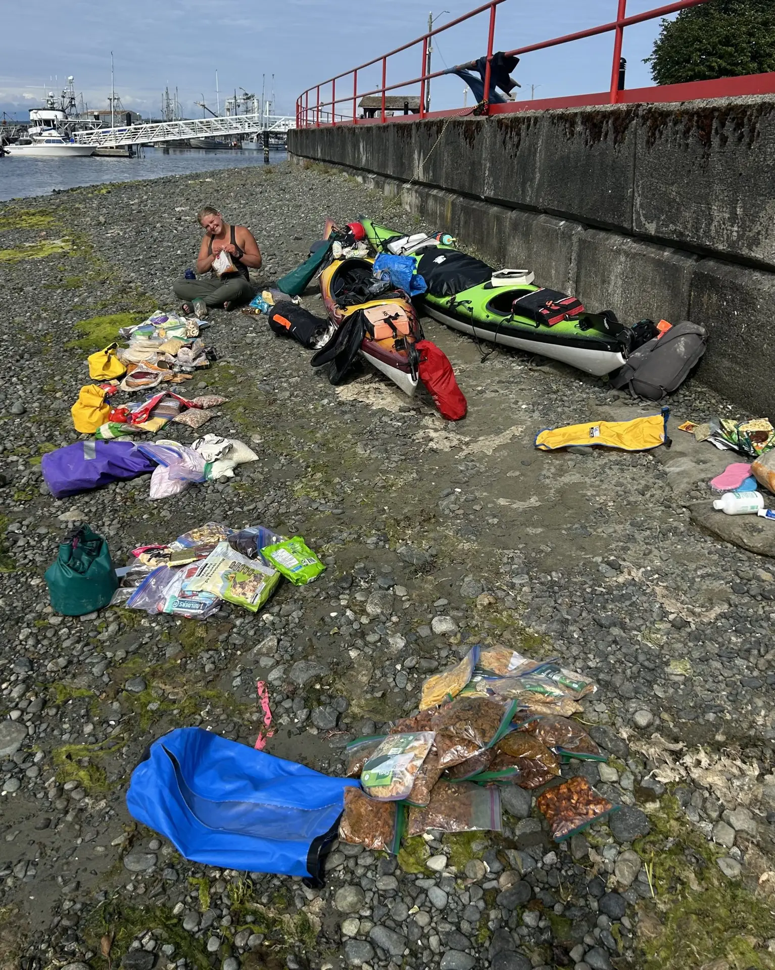
On day 20, we said goodbye to Erin in Port McNeill, and picked up a food resupply box that we had packed almost a month prior, which her parents graciously delivered to us. We enjoyed a hot shower and a delicious pub lunch, and spent most of the day organizing our food and gear on the beach and charging our electronics. We then pushed off for the most remote leg of the trip, loaded with enough food for nearly 30 days!
On the beach in Port McNeill, sorting all of our food for the next 30 days!
Part 3: Port McNeill to Kyuquot
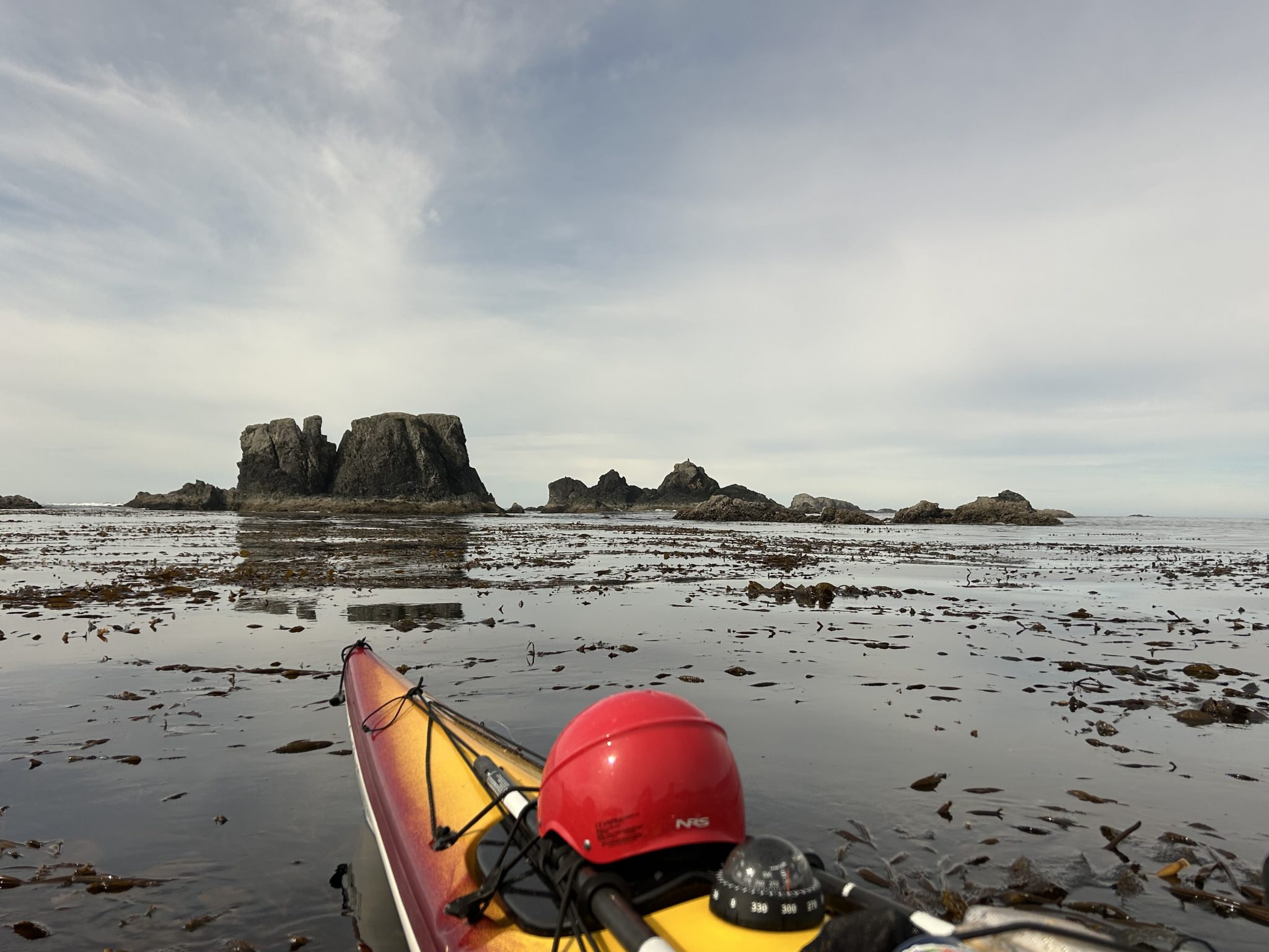
Two days after leaving Port McNeill, we made a detour to paddle through God’s Pocket Marine Park, a small group of islands north of Port Hardy that is renowned for its abundance of invertebrate marine life. As Clara and I are both recent graduates of the marine biology program at the University of Victoria, we couldn’t resist the opportunity to explore these islands.
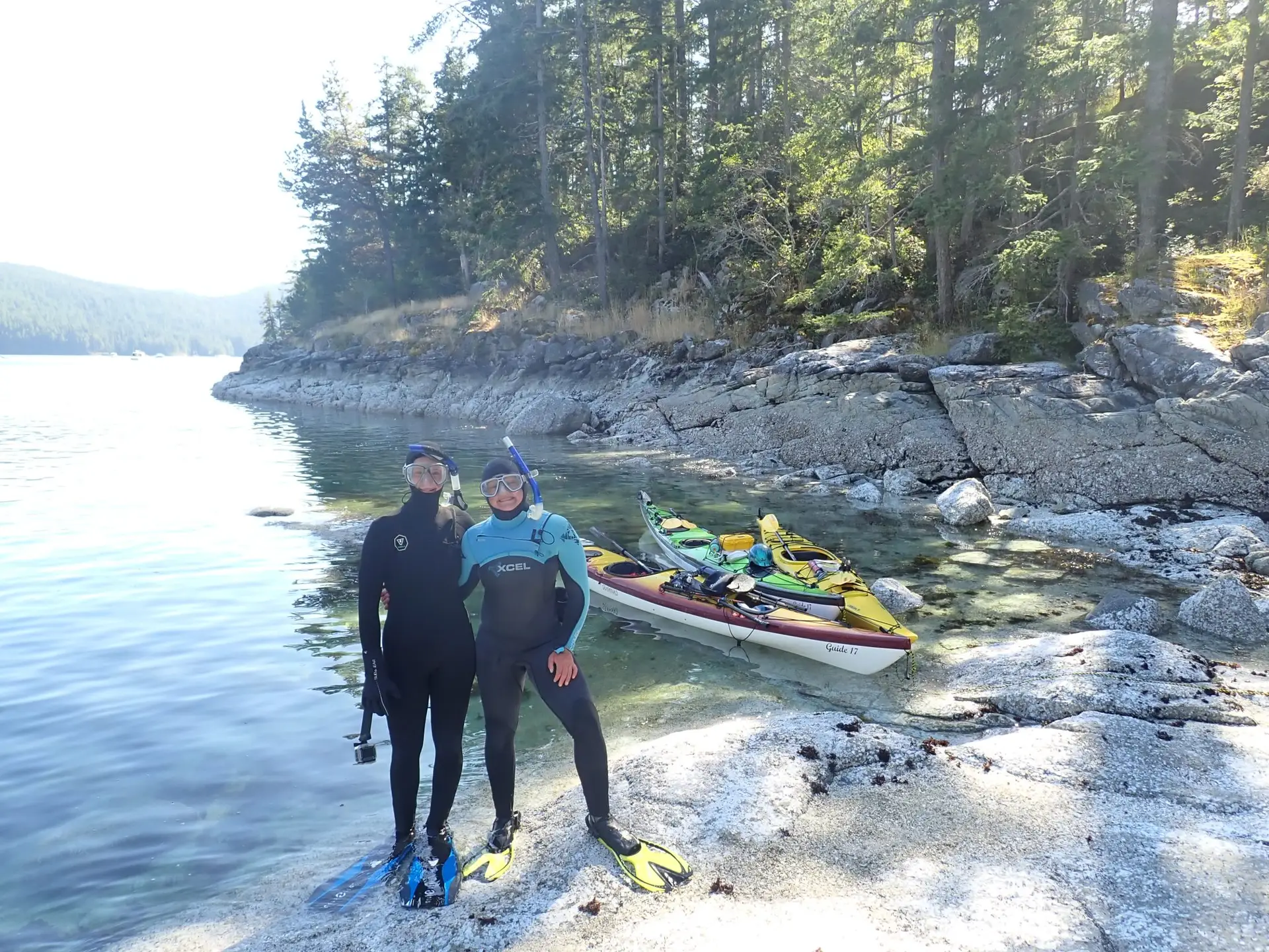
The morning of day 22 dawned calm and clear, and on a near-zero tide, we spent hours hugging the shoreline of the islands that make up God’s Pocket, marvelling at the intertidal life. The next day, we again took advantage of the morning low tide to snorkel in Browning Pass. Through chattering teeth, we couldn’t stop exclaiming over the walls of plumose anemones, the abundance of sunflower stars, and other amazing life. Though our boats were jammed nearly full of essential trip gear, we had managed to squeeze in our wetsuits, snorkels, masks, and fins, and on this day, we were so glad we did. God’s Pocket was just one of the places we took the opportunity to explore beneath the waves.
Our snorkelling setup allowed us to see the underwater flora and fauna in many new places.
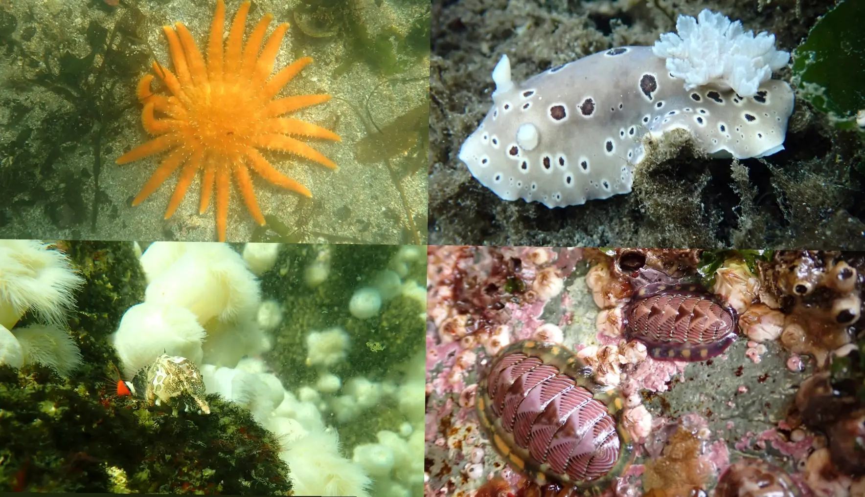
Some of the marine invertebrates we were lucky to see on our snorkelling adventures. Clockwise from the top left: Sunflower seastar (Pycnopodia helianthoides), Leopard dorid (Dialula odonoghuei), Lined chiton (Tonicella lineata), Grunt sculpin (Rhamphocottus richardsonii).
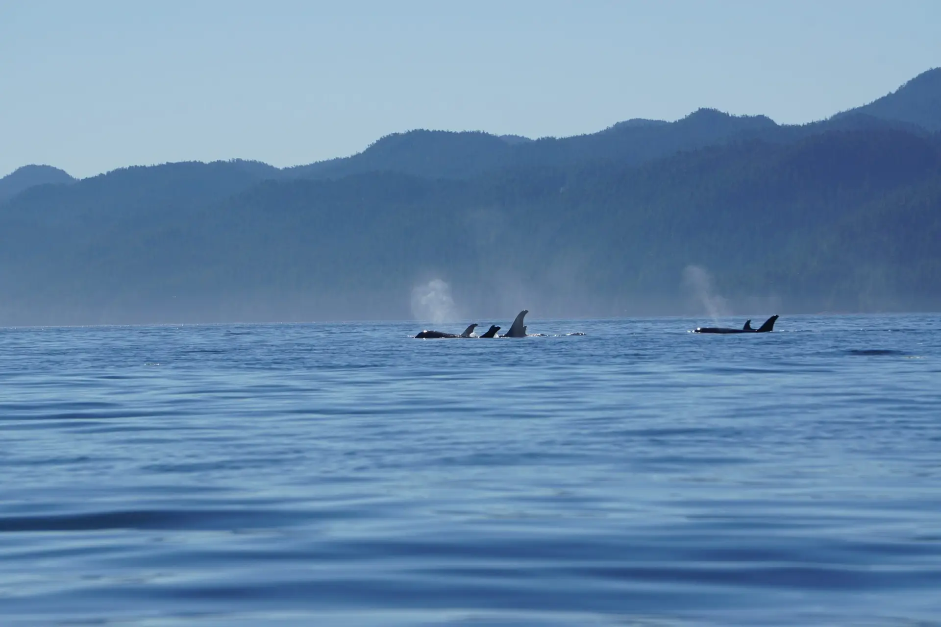
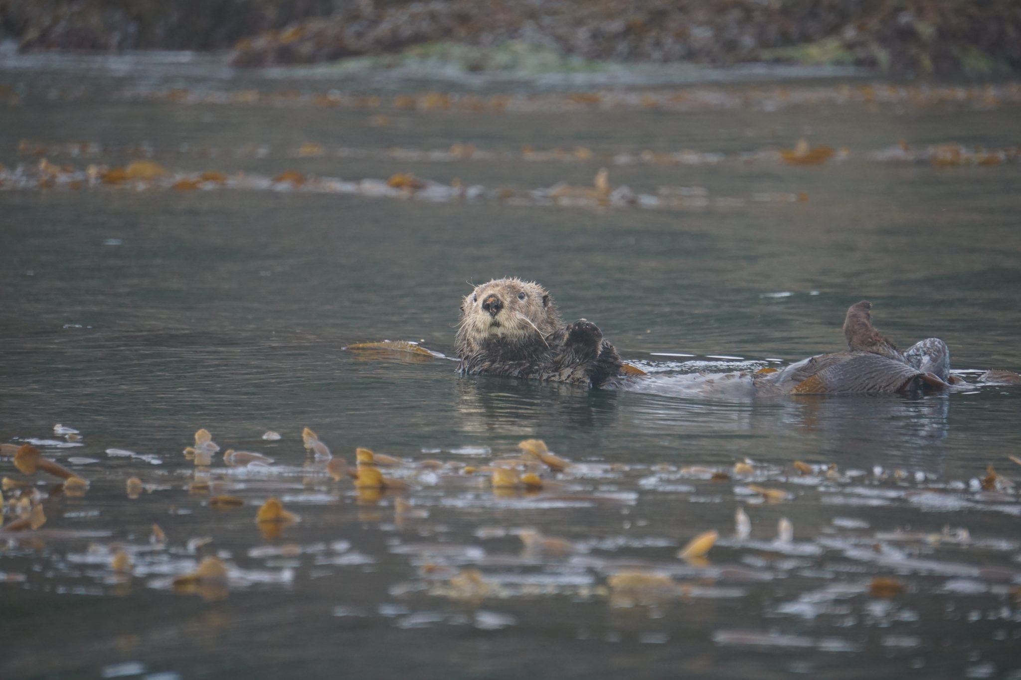
Day 24 was a magical day of whales. Almost as soon as we launched, we were surrounded by the sounds of breathing humpbacks, and could see two pods of resident orcas in the distance! We paddled parallel to the orcas for a while, and while one pod diverged, the other turned to cross the channel toward us! We rafted up to watch, and they swam past at a distance of a few hundred metres, silhouetted against the distant blue mountains of the mainland. After that encounter, we saw at least five humpbacks in the next few hours of paddling, including one tail fluke just 75 m away! We were also greeted by a group of about 20 adorable sea otters: the first raft we’d seen so far.
The pod of orcas that came to check us out on the morning of day 24. The dorsal fin of a small calf is visible near the middle of the front group.
We encountered countless sea otters, and seven rafts of more than 15.
As we rounded Cape Sutil, the northernmost point of Vancouver Island, we were met with a cold, crisp headwind, and could see dark fog banks on the distant horizon. Almost immediately, the rocky shelves and pebble beaches of the east coast gave way to the expansive sandy beaches and wave-battered headlands of the west, welcoming us into a new leg of the trip.
The evening of day 24 brought an unexpected challenge that we had not even thought to prepare for. As we turned on our VHF radio and inReach device to check the weather and send out our daily location update, we were met with multiple messages from our families, and a blaring emergency radio bulletin: there had been a massive earthquake off the coast of Russia that day, and the north and west coasts of Vancouver Island were under a tsunami advisory. This sent us into a nervous few hours of making plans and backup plans, and monitoring the advisory. By 10 pm, it was clear that the tsunami waves would be small enough not to impact our camp, and by the next morning, the advisory was removed. The tsunami had produced waves of only 30 cm along the coast.
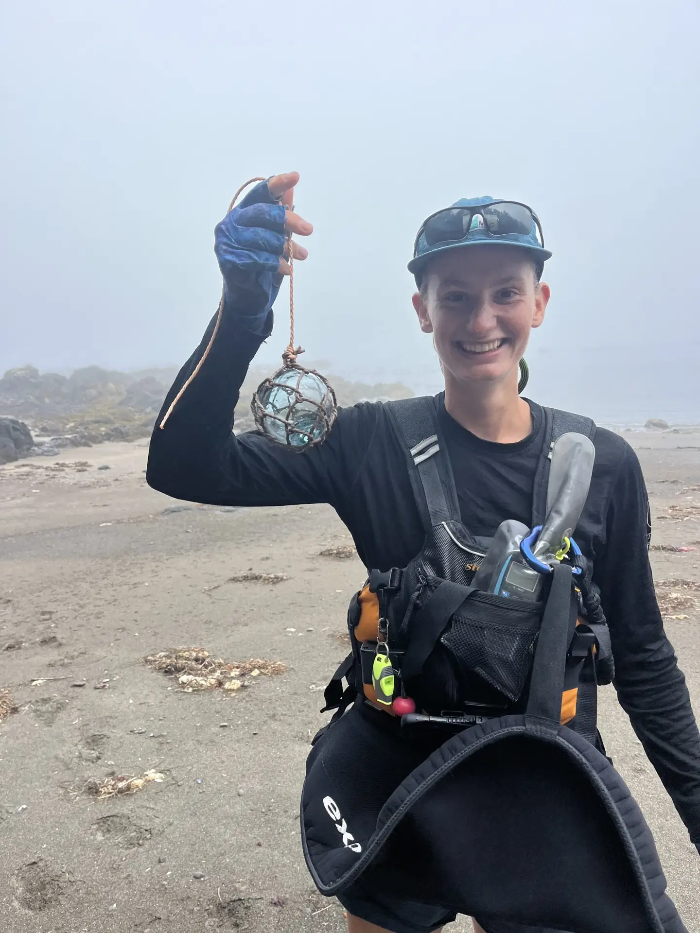
On the morning of day 26, we rounded Cape Scott, a major milestone. With a favourable current, a slight tailwind, and a light fog, the paddling was uneventful, save for a startling encounter with some territorial sea lions who weren’t happy about us interrupting their morning nap. A few hours after rounding the cape, we stopped for a break on a small beach, and I was excited to find a true west-coast beach combing treasure: a glass ball, a vintage Japanese fishing float!
A glass Japanese fishing float, a west-coast beach combing treasure!
With forecasts calling for a big low pressure storm moving in, the next few days were long ones, as we raced to put in enough miles to make it around Brooks Peninsula while the good weather held. We were excited to encounter a Mola mola (Ocean sunfish) near Quatsino Sound. These massive fish are uncommon in these waters, and at over half the length of our kayaks, it was an impressive sight. On day 28, we made it to the Crabapple Islets, our final stop before paddling around the notorious Brooks Peninsula. There, we enjoyed a stunning sunset over the huge white sand beach that we shared with only some coastal wolves.
Crabapple Islets beach; a huge, white sand beach just north of Brooks Peninsula that we had all to ourselves.
At 4:00 am on day 29, we reluctantly rolled out of our cozy tent, eager to get on the water at first light to avoid as much wind as possible. Essentially an 8 by 13-km rectangle sticking straight out into the open ocean, Brooks Peninsula is known for concentrating incoming wind and wave energy. Combined with its rugged shoreline that offers virtually no landing possibilities, this was the part of the trip we were most apprehensive about. After tearing down camp by headlamp and eating a starlit breakfast, we donned our dry suits, packed the boats, and were on the water by 5:45 am, as a pink sunrise lit up the sky. By 8 am, we rounded Cape Cook, the northwestern corner of the peninsula. Already, the wind was blowing at a consistent 20 knots, gusting to 25, and the sea was getting choppy. Luckily it was a tailwind, and, hoping that it wouldn’t pick up more, we paddled hard and flew down the outside of the peninsula, getting soaked by the 2-3 ft waves that splashed over our sterns and pushed us along. Luckily, the wind died down after that, and the rest of the day was uneventful. We continued to paddle well offshore, watching the waves crash against the exposed and beautiful coastline. At 1:30 pm, we arrived at our campsite. After 7.5 hours and 20.2 nautical miles (37 km) in the boats without a break, we were grateful to be back on solid land.
As predicted, the sky darkened and the wind strengthened to a gale force south-easterly the next evening, and we were glad to be around Brooks and tucked into some cozy islands to hunker down and wait out the storm. For the first time on this trip, our boats did not touch the water on day 31 We took advantage of the weather to catch up on some sleep, rest our tired muscles, and enjoy fresh-baked cinnamon buns and focaccia bread; a welcome change from oatmeal and dehydrated curries.
Part 4: Kyuquot to Tofino
After visiting a friend who works at a fishing lodge in Kyuquot (and gratefully receiving gifts of chocolate and our second warm shower of the trip), we tucked behind Nootka Island to get a break from the incessant swell of the west coast, and visit a beautiful waterfall. Day 36 saw us arrive at the beach in Nootka Sound where we would be stuck for the next three days as the weather switched again, bringing 40-knot winds and 5 m swells that made rounding Hesquiat Peninsula impossible. It was, however, not a bad place to be stuck! The weather was sunny, and we spent our time snorkelling, body surfing the big waves that rolled onto the beach, walking in the forest amongst giant cedars and fir trees, showering in the nearby waterfall, playing cards, reading, and beachcombing. For three days, our only company was two coastal wolves and a friend in the Nootka Sound coast guard who paid us a visit.
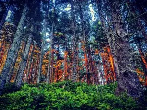
A beautiful forest of giant kelp amidst some rocky shelves and breakers in Kyuquot.
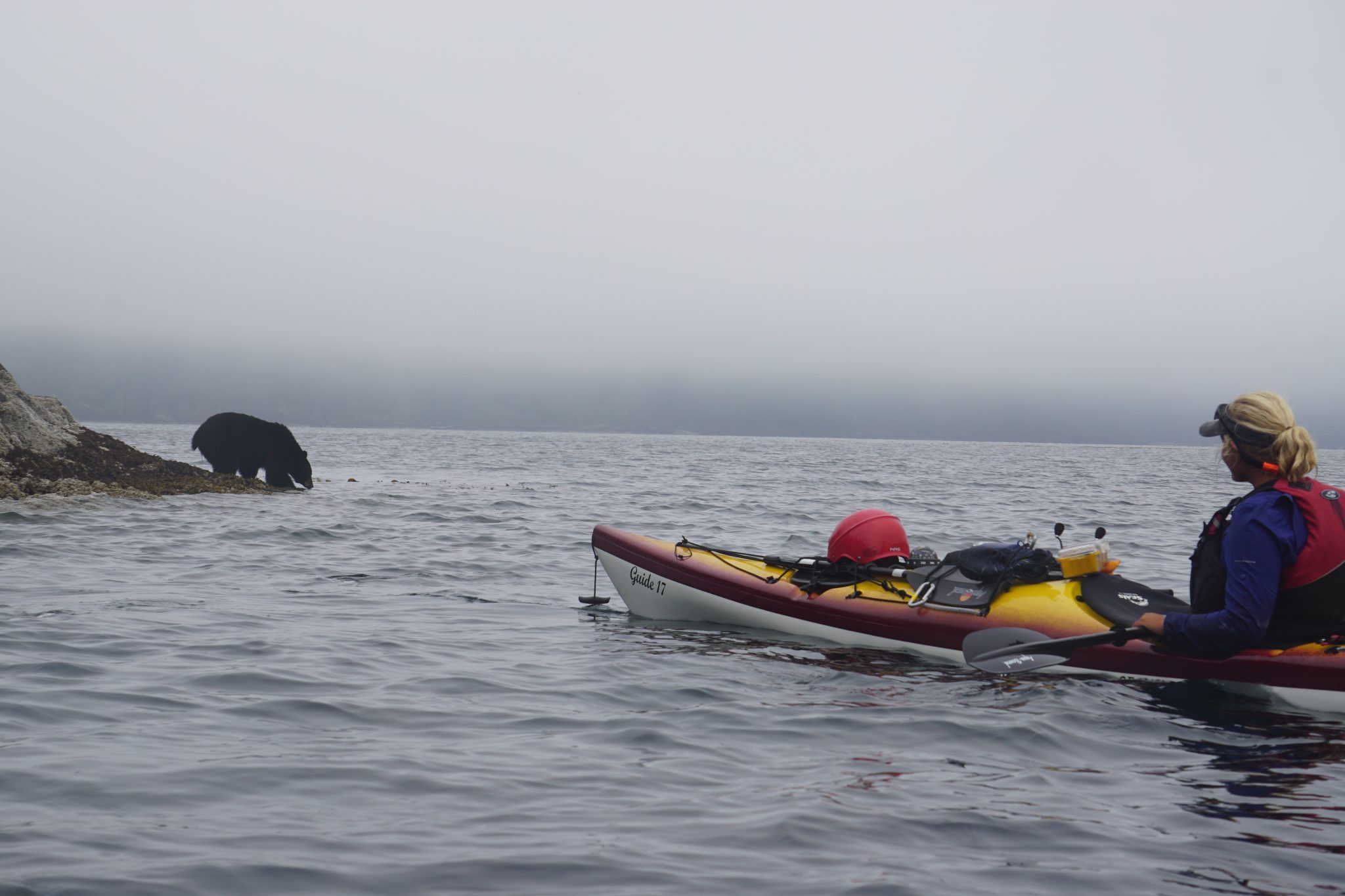
A black bear in Kyuquot Sound didn’t seem to mind us watching him flip rocks, looking for intertidal goodies.
On day 39, we were on the go again, pushing closer to Hesquiat peninsula despite large swells that made the day an uncomfortable combination of big surf landings and seasickness. On the morning of day 40, we were met with a puzzling surprise: as we loaded the kayaks, Clara’s 20 L dry bag of clothes was nowhere to be found. After a few minutes of confused searching, we located the missing bag deposited below the last high tide line, with wolf tracks all around it! After finding the missing bag and thanking the wolves for leaving it there after the last high tide (otherwise we might never have seen it again!) we set off to paddle around Hesquiat Peninsula, the final crux point of the trip.
This day proved the most difficult of the trip, with a stubborn headwind that intensified as the day went on, and a cold, insistent rain that soaked us to the bone. At first, we had grand plans to make it all the way to Hot Springs Cove, but fairly quickly we revised our goals to just making it to the first place we could land. We spent a miserable seven hours picking our way between huge breakers, soaked by waves that broke over our bows every few seconds, and fighting a strong current and a stronger headwind that pelted us with driving rain. A few tears were shed, but eventually we made it into the shelter of Hesquiat Harbour, where we found a flattish spot in the forest for our camp. We put up tarps, boiled water for soup and hot water bottles, and collapsed into the tent.
The next four days were a soggy struggle as we pushed down along the coast towards Tofino in a nearly constant rain and headwind. The only break was a wonderful evening soaking in the hot springs, before setting off back into the wind, waves, and rain the next morning. We spent our paddling hours shivering in wet gear, our lunch breaks hunkering under soggy branches, and our camp evenings finding a bit of shelter in our damp tent. Eventually, we made it to Tofino on day 45. There we spent an amazing day drying our clothing at a laundromat, eating fresh food, drinking real coffee, and feeling warm and dry for the first time in what felt like forever.
Our fifth rainy day in a row. Everything was soaked, including our clothes, tent, sleeping bags, and all of our paddling gear.
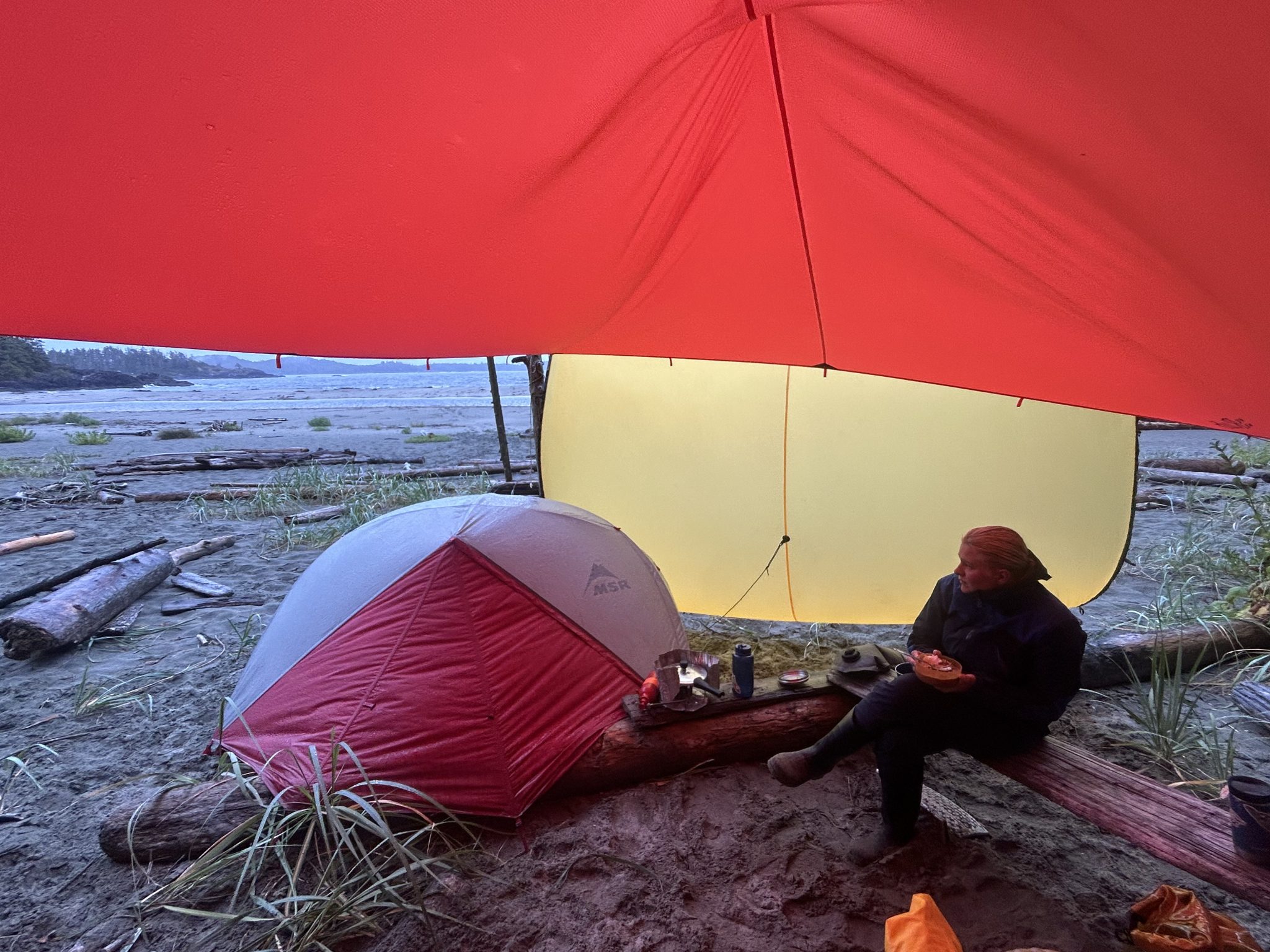
Our camp on Vargas Island, with the yellow tarp to block some of the rain that was being driven sideways into our camp by a 30-knot wind.
Part 5: Tofino to Salt Spring Island
Setting off from Tofino, we were blessed with sunshine and tailwinds again, and we put in our longest day of the trip, paddling a full 26 nautical miles (48 km) to some islands near Ucluelet. From there, we crossed into the Broken Group Islands and spent a few days exploring. After not sharing any of our campsites since day 24, it felt odd to encounter other paddlers. There was even a family travelling on a motor-boat who pulled out massive tents, a barbecue, whole watermelons, coolers of chilled drinks, generators, and giant inflatable mattresses. We were most jealous of the mattresses, since ours had both popped beyond repair, and we had been sleeping on the ground since day 30. Our Broken Group highlight was snorkelling in a giant tide pool, complete with a full kelp forest and an eelgrass bed! After crossing to the Deer Group, we stopped in Bamfield to visit some people at the Bamfield Marine Sciences Centre, where Clara and I had studied for the fall semester last year. The next morning, we woke to a mama bear and her two small cubs up a tree less than 10 m from our camp, and slowly moved our things down the beach to get out of her way.
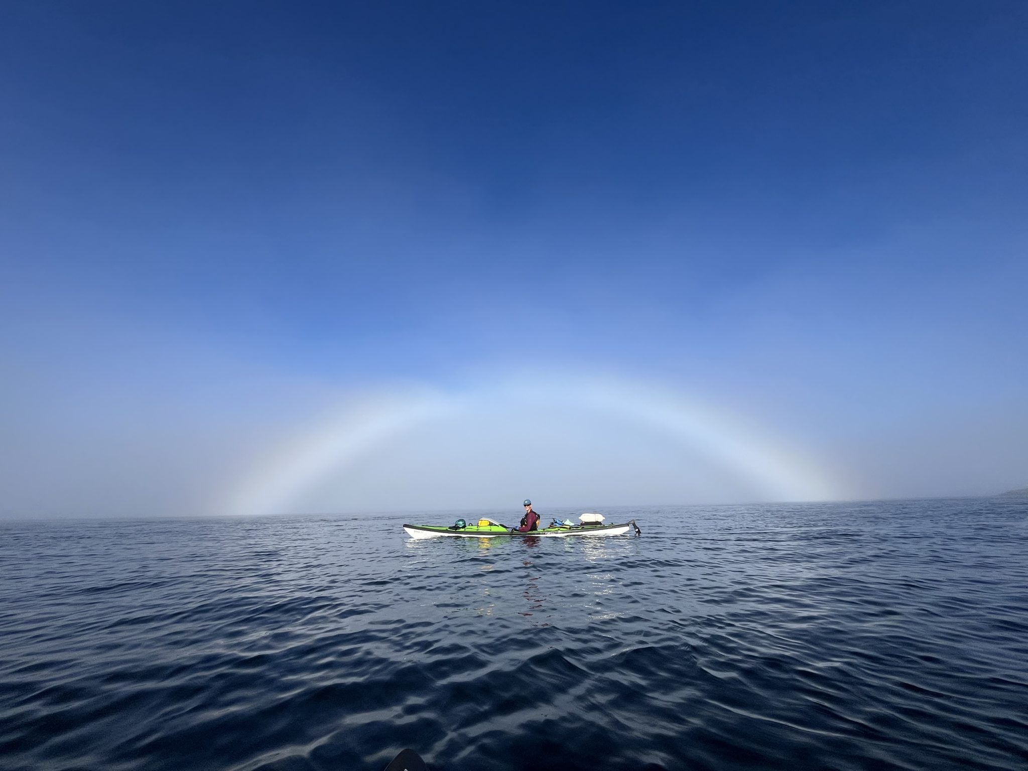
A cool fog rainbow appeared as we were leaving Vargas Island to head south to Ucluelet.
Clara paddling on a glassy-calm morning in the Broken Group Islands.
As we paddled along the coastline of the Juan de Fuca Strait, we started to feel the physical wear of paddling for 50 days in a row. An aching back and wrists, numb fingers and toes, a pinching pain radiating through my right shoulder, and a popping in my right ribs with every stroke was the new normal. Luckily, the good weather held, and we made good time down the Strait. Except for one nerve-wracking interaction with more territorial sea lions who trapped us between their aggressive barking and a huge surf landing that we did not want to attempt, it was smooth sailing. On day 54, we paddled past Victoria, and were overwhelmed by the noise of the city, and glad to escape to Discovery Island for the night. With a few extra days to spare, we took our time paddling up through the Southern Gulf Islands, spending our last night on Prevost Island, at the exact same campsite as the first night of the trip. On day 58, we launched our kayaks for the last time, and made the short crossing back to Salt Spring Island, where we pulled up on the same pebble beach we had launched from almost two months before.
In planning this trip, we benefited a lot from chatting with other paddlers and reading accounts of similar trips. If you are thinking about attempting a similar trip and want to chat, or want to hear more about our trip, please don’t hesitate to contact us! We can be reached at sarahric11@gmail.com or clarahudacin@gmail.com.
Trip Stats
Total days: 58
Total Distance: 730 nautical miles / 1,350 km
Total paddling time: 310 hours
Number of campsites: 49 (only 15 of them shared with other people)
Longest day: 26 nautical miles / 10.25 hours of paddling
Average distance per day: 14.5 nm
Average time on the water: 5.8 hours
Estimated total paddle strokes: 1 million
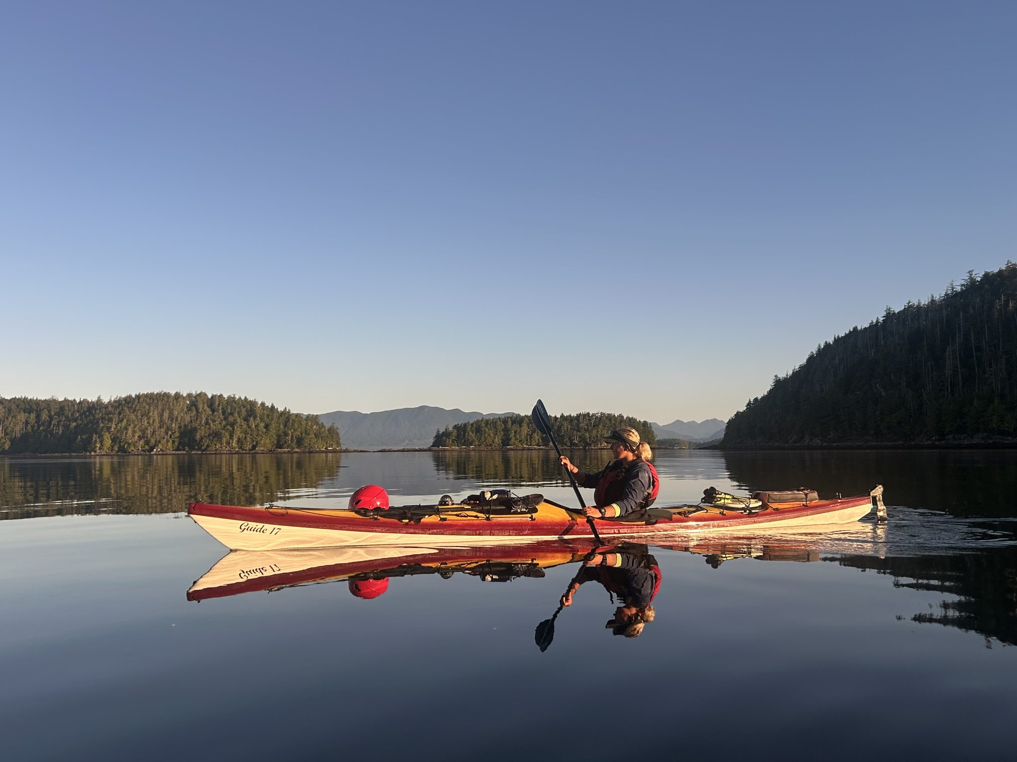
“Kermit” and “Stewie”, our wonderful Seaward Guide 17 kayaks!
My outback oven, which enabled us to bake fresh cinnamon buns, focaccia bread, brownies, and pizza!
Our big tarp, which kept us dry (ish) through many rainy days.
Our inflatable seat cushions, which made long hours of sitting the kayaks more tolerable, and also doubled as hip-pads at night for the second half of the trip when our sleeping pads no longer held air for the whole night.
“Gogo”, my amazingly light greenland paddle that saved my sore shoulder on many long paddling days
Worst Gear items
Our sleeping pads, which popped beyond repair on day 30 and 40.
Our water filter, which stopped working very well about half way through the trip, making us fill up our water bags at lodges and towns along the way
Our solar panel, which worked great to keep our electronics charged for awhile, but stopped working about half way through
Our paddling jackets, which proved not very waterproof during our week of rain
Sarah Richards grew up on Vancouver Island. She loves the outdoors and is an avid paddler, climber and diver. She has worked as a kayak guide. She recently graduated from the University of Victoria with a degree in marine biology.
I really enjoyed reading this. Thanks for writing it! My husband and I and a friend paddled around VI in 2018, also in 58 days. It is so nice to be able to take time to explore the coast and not to rush around in a month. Our combined ages for the trip was 186, so we needed lots of time for the older bones and joints haha.
We use basic cookie information to track things like which pages are viewed by visitors, in order to help improve our content. This information is used within Google Analytics, but is not provided to third parties.
By continuing to use this website, you consent to the use of cookies in accordance with our Privacy Policy, which can be found at the bottom of this page.
Thanks for sharing! Love the stats and the gear ‘awards’!
I really enjoyed reading this. Thanks for writing it! My husband and I and a friend paddled around VI in 2018, also in 58 days. It is so nice to be able to take time to explore the coast and not to rush around in a month. Our combined ages for the trip was 186, so we needed lots of time for the older bones and joints haha.
Great article and fantastic photos. You’ve really made your adventure come alive for me. Thanks for sharing!