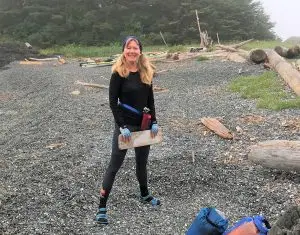
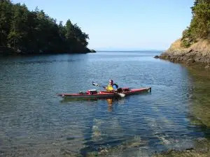
A new layer of user reported sites is now visible on the BC Marine Trails map within Heiltsuk Territory (much of the Central Coast)! These locations have been identified by recreationists through BC Marine Trails’ Site Condition Reports (SCRs), then reviewed by our partners at the Heiltsuk Nation for concurrence, but have not yet been verified for safety or camping suitability. They are included on the map to support informed access, and to invite your help. While historically sites on the BCMT map have been visited and verified by members of the Trails Development Committee, trusted site assessors, or BCMT staff, this new approach will allow for contribution from all SCR submitters.
Note: User reported sites should not be relied on for trip planning as conditions and camping suitability may differ from description.
To view reported sites (member map only feature), head to the ‘layers’ section and toggle on ‘BCMT Reported Sites’. Click on reported site icons to view what information has been submitted by users.
If you are paddling in Heiltsuk Territory and choose to visit a reported site, we encourage you to submit a Site Condition Report. Your observations will directly support BCMT and the Heiltsuk Nation in evaluating these sites, and providing up-to-date information to map users. Information on landings (at various tide heights), tent sites, fresh water access, and photos are always appreciated.
Too often, engagement with First Nations is seen as a barrier to public access. But our work with the Heiltsuk Nation tells a different story.
Over the past several years, BC Marine Trails and the Heiltsuk Nation have built a relationship grounded in respect, reciprocity, and shared goals. What began with initial engagement in 2016 has grown into a dynamic partnership, including a renewed Memorandum of Understanding, regular check-ins, and joint review of nearly 500 marine sites.
The outcome? Of sites reviewed in Heiltsuk Territory, only 28 were found to be too sensitive for public visitation. The vast majority, 406 sites, were deemed suitable for public access. Many of these now appear as user reported sites on our map, allowing paddlers to see where others have camped or stopped, and to contribute their own observations to help shape how they are displayed on the BC Marine Trails map. The review was guided by the direction and leadership of the Heiltsuk Nation, whose stewardship of these lands and waters stretches back to time immemorial, and reflects a commitment to ensuring public recreation follows Indigenous management directives.
This work highlights the strength of citizen-based reconciliation and the importance of developing coastal access alongside First Nations through dialogue, transparency and mutual respect. We are grateful to the Heiltsuk Nation for their guidance and partnership and we remain committed to supporting their ongoing stewardship efforts.
So the next time you’re paddling the Central Coast, keep an eye out for new reported sites. And if you land at one, snap a photo, and send in your report. To learn more about the Heiltsuk Nation and to prepare for your visit, check out qatuwalas.ca and hirmd.ca.
This coast is alive, and so is the map we build together.
This work was undertaken as part of BC Marine Trails’ First Nations Engagement Program, which supports Indigenous led stewardship and ensures that public recreation aligns with local values, governance and land management directives. To learn more, visit: Partnering with First Nations. The program has included support from the Real Estate Foundation of BC and the Rural Economic Diversification & Infrastructure Program (REDIP).