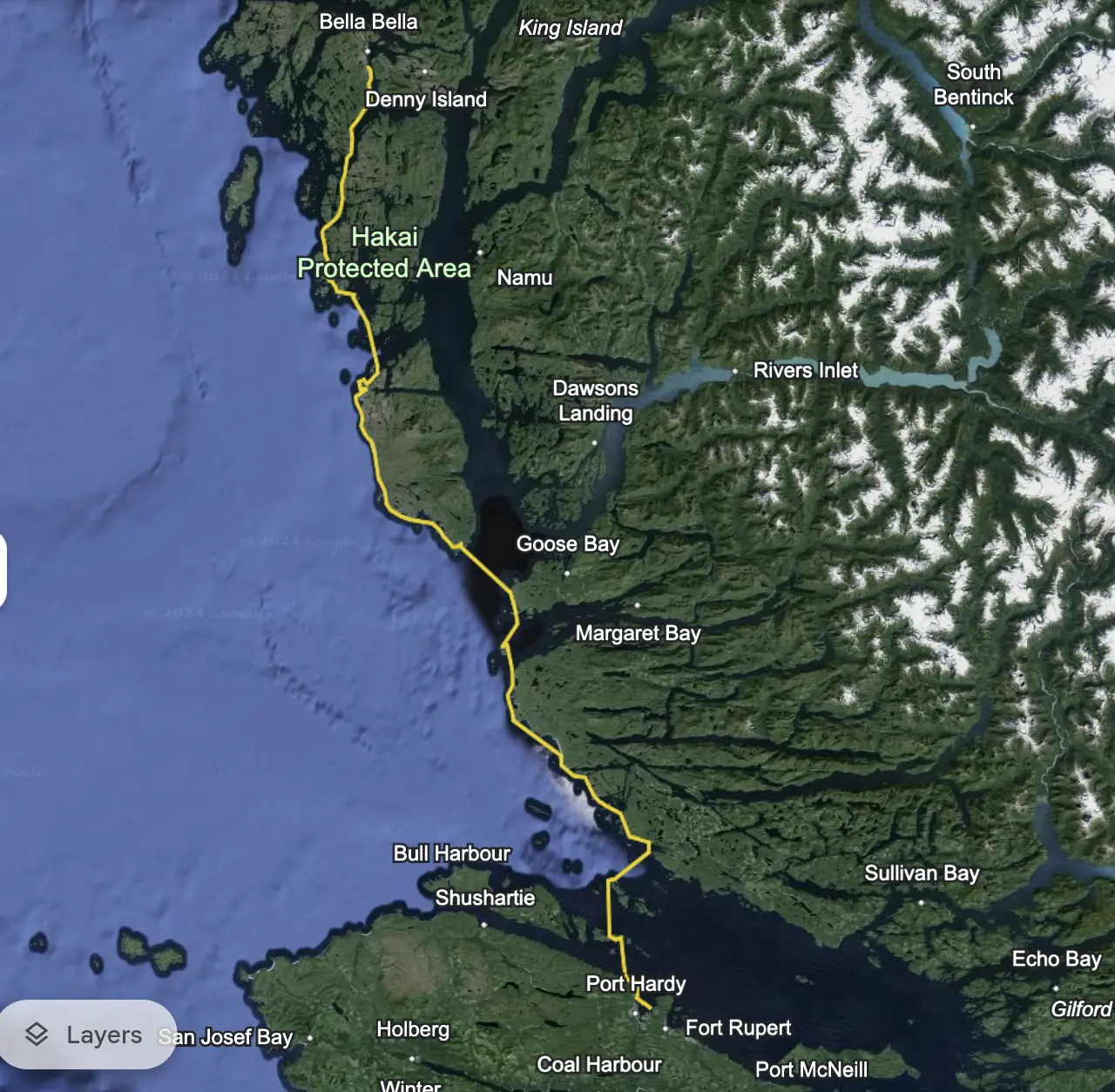
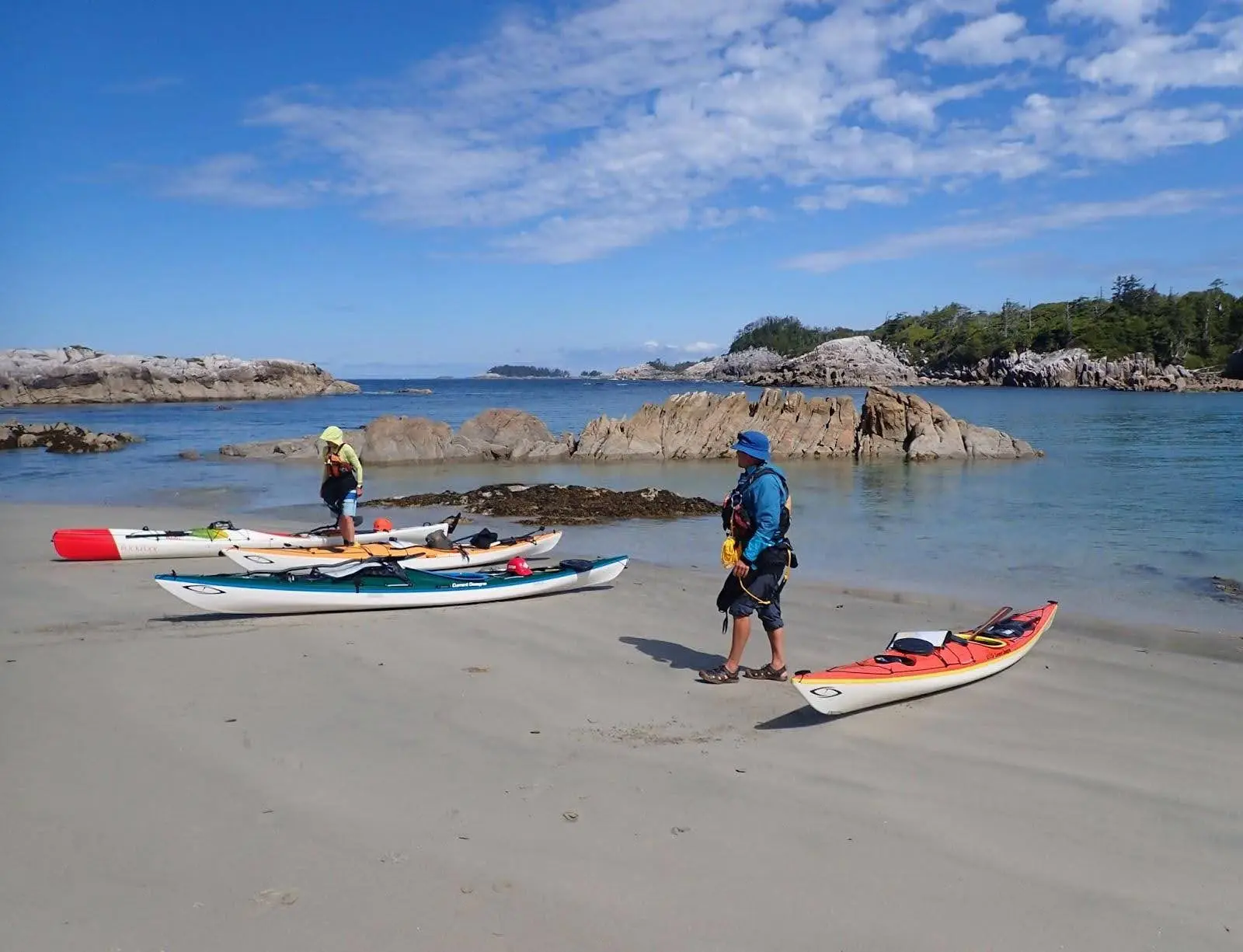
In July 2024, our group of four experienced paddlers embarked on a 120-nautical-mile kayaking journey along the Central Coast of British Columbia, from Bella Bella to Port Hardy. The trip, carefully planned and prepared, aimed to balance remoteness with logistical ease using BC Ferries for the northbound leg, followed by paddling south back to our vehicle in Port Hardy. The group consisted of me, my husband Eric, and two friends, Pat and Jenna. We planned to complete the journey within 14 days, with some buffer for rest and weather delays, hoping July would produce favourable weather.
Read the prior Part 1 article to explore the preparation and planning that went into this trip.
The Route
Favourable weather allowed us to paddle the outside route on the west side of Calvert Island, as we had hoped to do in our plan.
| Route | Distance | Rest and Lunch Locations | |
| Day 1 |
5.5 hour ferry from Bear Cove (Port Hardy) to McLoughlin Bay (Bella Bella) McLoughlin Bay (Bella Bella) to Soulsby Camp (Campbell Island) |
9.2 nm |
|
| Day 2 | Soulsby Camp (Campbell Island) to Edna Island | 13.5 nm | Cultus Sound |
| Day 3 | Edna Island to North Beach (Calvert Island) | 12.4 nm | Serpent Group, Choked Passage sandspit (Calvert Island) |
| Day 4 | North Beach (Calvert Island) Rest Day | Rest | |
| Day 5 | North Beach to Blackney Island (Calvert Island) | 12.4 nm | Dublin Point North |
| Day 6 | Blackney Island to Grief Bay (Calvert Island) | 10.3 nm | Calvert Island SW |
| Day 7 | Grief Bay (Calvert Island) to Table Island | 13 nm | Kelp Head south, Extended Point |
| Day 8 | Table Island to Burnett Bay (North) | 13 nm | Indian Cove |
| Day 9 | Burnett Bay (North) | Rest | |
| Day 10 | Burnett Bay (North) to Shelter Bay | 15.1 nm | Skull Cove |
| Day 11 | Shelter Bay to God’s Pocket (Bell Island) | 13 nm | Kent Island |
| Day 12 |
Lycette & Eric: Bell Island to Hardy Bay NW (layover due to dog/house sitter booked until Day 14) Pat and Jenna: Bell Island to Bear Cove, Port Hardy |
L & E: 5.4 nm P & J: 8 nm |
|
| Day 13 | Hardy Bay NW | Rest | |
| Day 14 | Hardy Bay NW to Bear Cove, Port Hardy | 2.7 nm |
Expedition experience
Overall, the trip included so many memorable experiences along the way, from stunning landscapes and wildlife sightings to overcoming personal challenges.
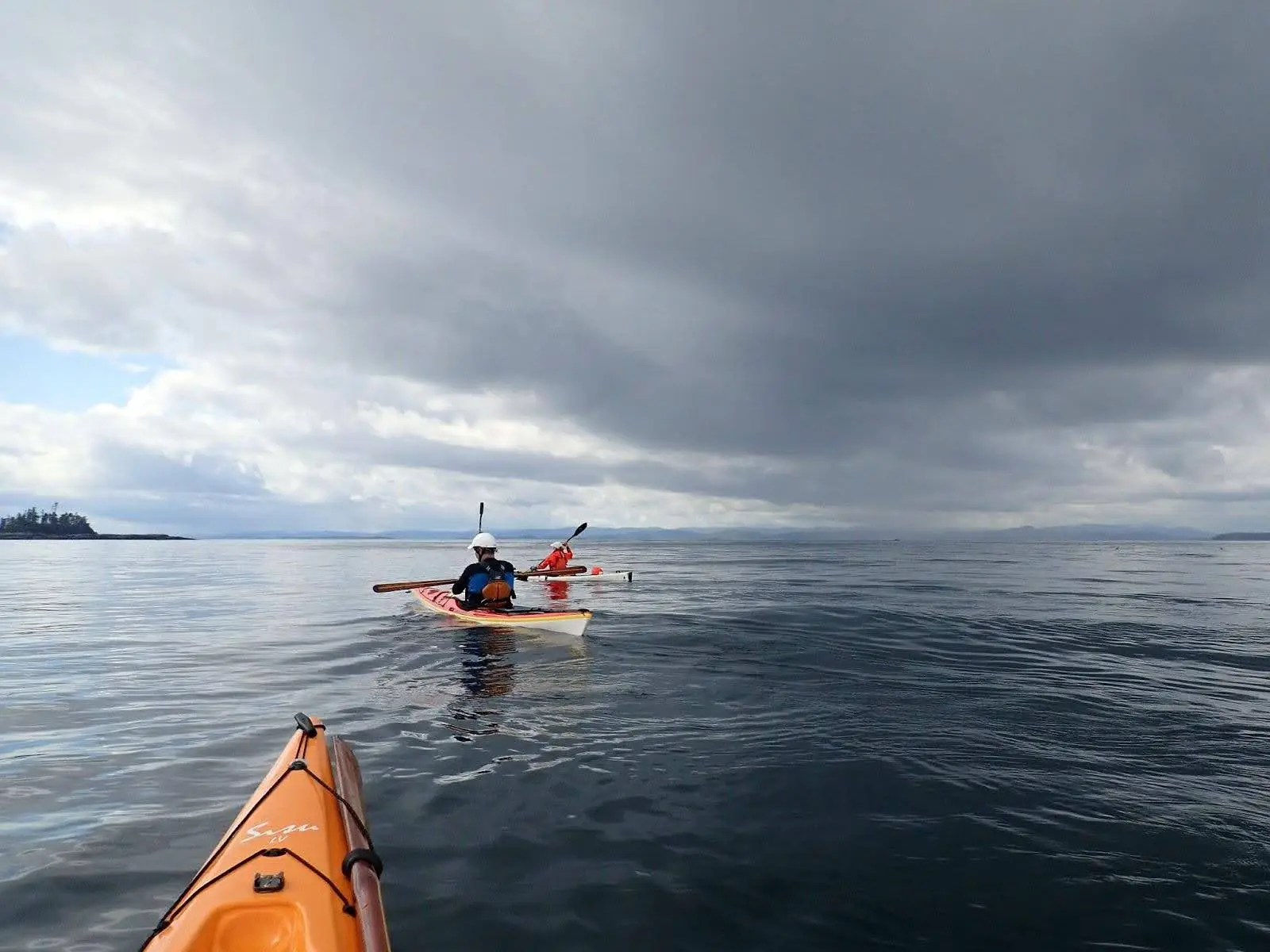
Conquering long, committed crossings
The trip included two major crossings, both of which were undertaken after frequent weather checks. Weather conditions were favourable, allowing us to stay on schedule and avoid challenging seas for the crossings.
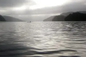
The first was Grief Bay (Calvert Island) to Kelp Head (mainland) across Fitz Hugh Sound, a passage for ferries and cruise ships. We launched early at 7 am with a forecast of 1 m swell and 5 knot N winds. The 5.5 nm crossing was a mind-numbing challenge but manageable, with no fog or ship traffic, and we completed it without stopping as there were no islands in the middle.
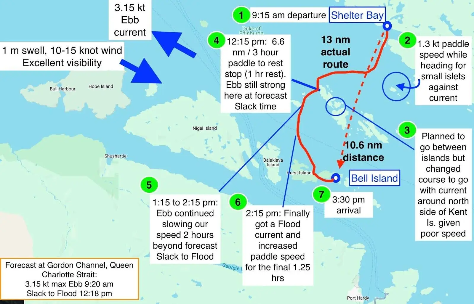
The second crossing, from Shelter Bay (mainland) to Vancouver Island, aimed for God’s Pocket Marine Park islands located just off Vancouver Island, as no campsites were situated on the islands in the middle. The forecast was 1 m swell, 10-15 knot N winds and clearing fog. We underestimated the impact of currents in Ripple Passage given the timing of our departure (9:15 am). With such a long crossing ahead of us, we didn’t want to delay our start any further by waiting for currents to improve in case wind and swell increased. At times, we endured a 3 knot current, which added 2.4 nm to the journey, and made the crossing a long and slow 13 nm instead of the expected 10.6 nm. Islets in the middle provided a rest stop, and we reached God’s Pocket successfully, yet tired.
Kelp Head and Cape Caution havoc?
I had been anxious about rounding Kelp Head and Cape Caution based on harrowing accounts from other paddlers. However, we were lucky with the weather for both. Arriving at Kelp Head after crossing from Grief Bay was uneventful, with only some chop at the head, and we easily entered the cove south of the head for a break. Rounding Cape Caution was also choppy with moderate current, but the group felt it deserved to be called “Cape Meh” due to its lack of exceptional challenges.
Class II conditions in Class IV waters
Pat’s mantra—“The key to paddling Class IV conditions is to avoid paddling in Class IV conditions”— helped convince me to join this expedition. Thankfully, we didn’t encounter any Class IV conditions. The strongest wind we faced was a forecast of 15-25 knots SE on a planned rest day. On all other days, wind remained under 15 knots and swell less than 2 meters. Waterspout warnings were in effect for a couple of days but we did not encounter any! The mouth of Slingsby Channel had the largest swell of the entire trip.
Crossing Slingsby Channel at Max Ebb, a cautionary tale?
We successfully navigated Slingsby Channel during maximum ebb (8 knots) by using the current to our advantage. We followed shoreline eddies and ferried across the channel to avoid the rough 2-meter swell at the mouth, a strategy we had planned the day before using current tables and charts. Despite the lack of cautionary warnings or current markers on charts, we found this crossing required more preparation and strategy than other areas, like Kelp Head and Cape Caution. Awareness of the Nakwakto Rapids upstream contributed to the cautious approach.
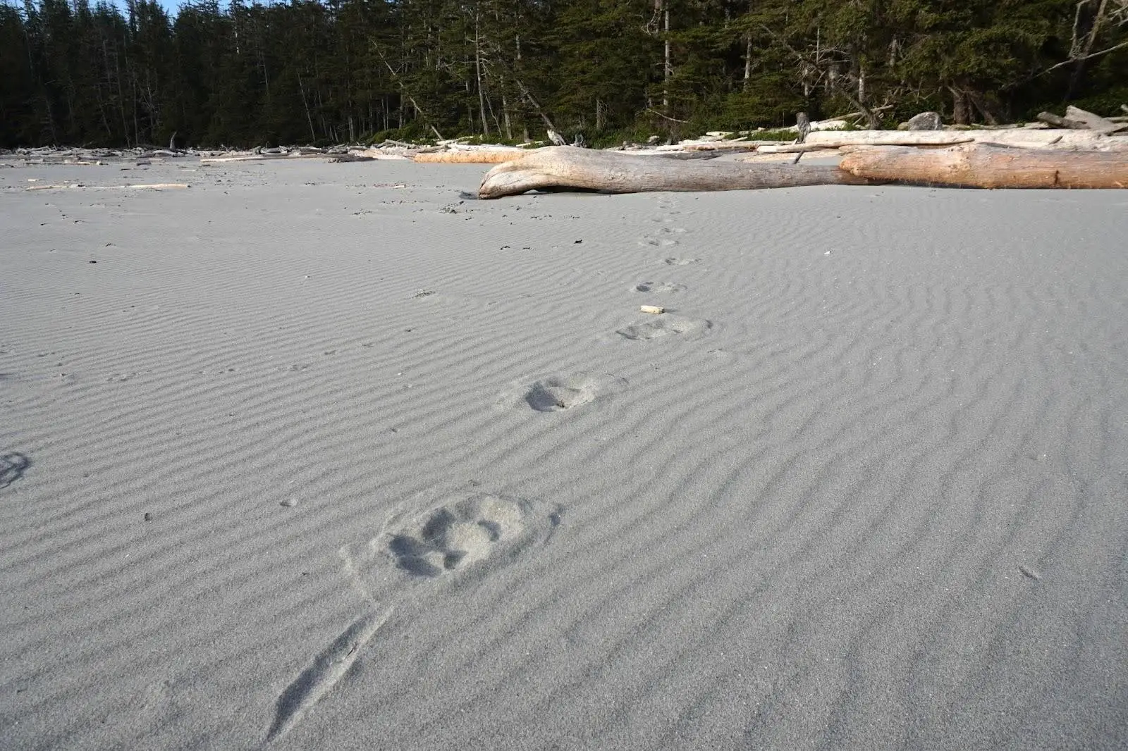
Wildlife: wolf footprints and humpbacks
I had wished for my first glimpse of a wolf on this trip. It was not to be, but still I was ecstatic to at least see wolf footprints at a few beaches.
Later in the trip (beyond Table Island), humpback sightings were common. We would do our best to avoid getting in their path and give them a wide berth, but we could not predict where they would next surface. Sometimes this was too close for comfort; one randomly surfaced 100 m in front of me and pointed directly at me – of course this led to panic as my greatest fear is to be capsized by a humpback!
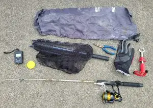
How to launch a bear banger
Before the trip, there was significant discussion about safety in potential grizzly bear encounters, including food storage. Despite being prepared with predator safety gear and always keeping it nearby (bear bangers, alarm fencing, bear sprays, and a 120 dB air horn), no signs of bears were encountered. On the second night, we practiced using bear bangers, launching one to test its range. Food was stored in kayak hatches, which was the group’s chosen method after some debate, and it worked out without any issues.
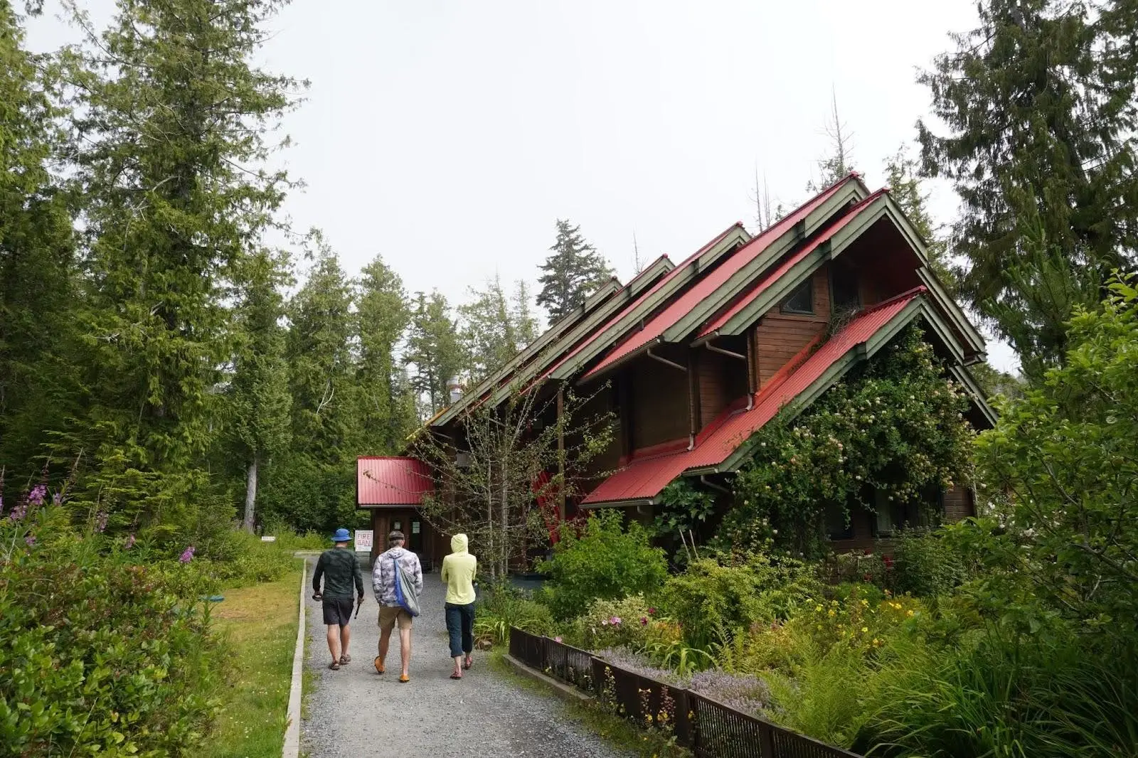
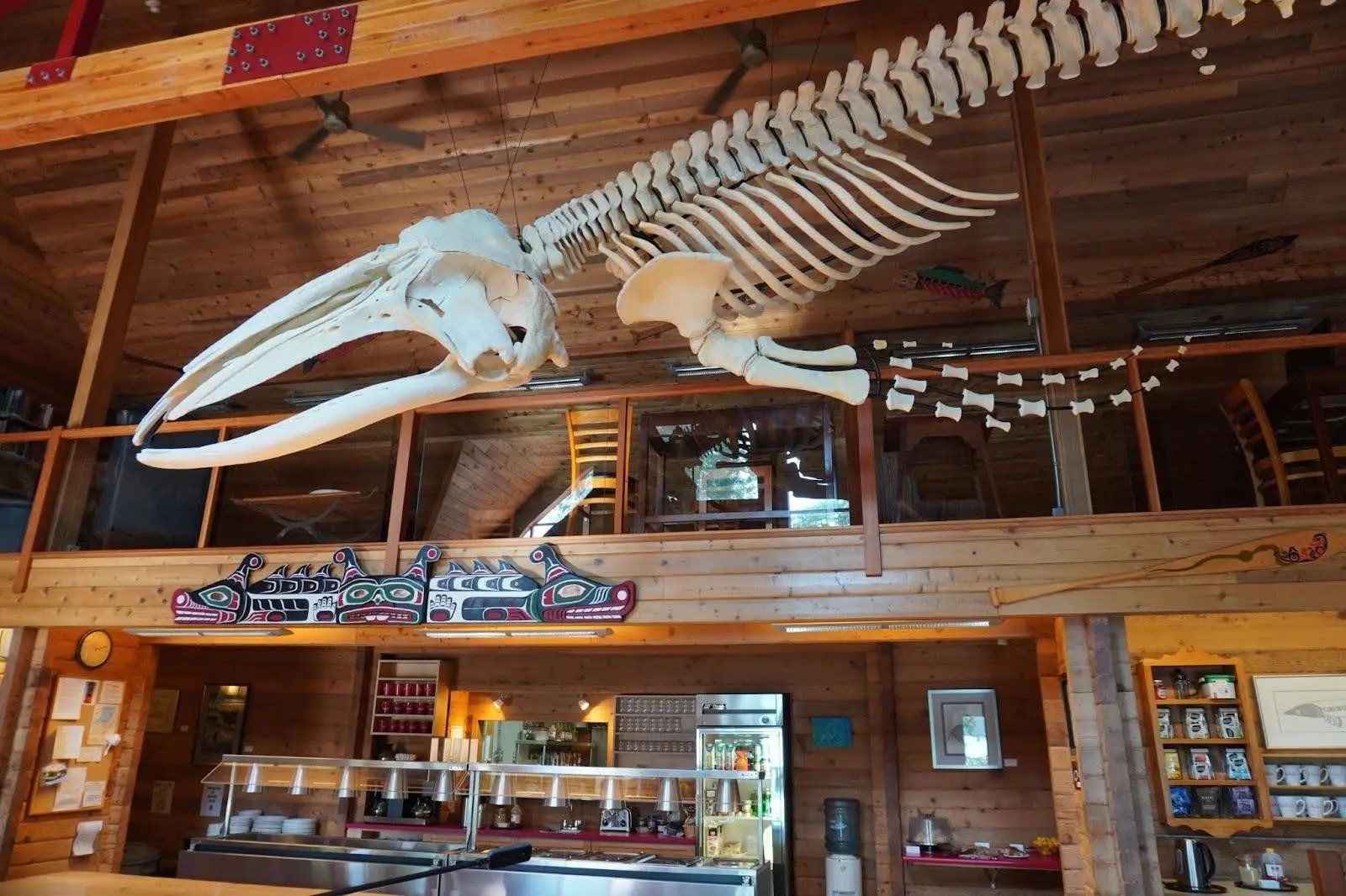
Hakai Institute tour
We had a planned rest day at North Beach on Calvert Island and hiked to the Hakai Institute for a pre-arranged tour, organized through Pat’s connections. The tour, led by one of the institute’s founders, featured highlights such as the ocean glider, which collects data from the ocean floor, and the skeletons of a humpback whale and sea otter in the dining hall.
Spring high tide and a close call on tent location
We camped at Grief Bay during spring tides, expecting the highest tides of the trip at 4.5 meters at 1:30 am. With limited tent locations between logs, we carefully assessed tent and boat placement, as we did at every camp. Pat woke up at midnight to find the water only about 1 meter from his tent. He also checked the kayaks, which were fine but close to the water. It was a close call, but there were no better options for tent placement.
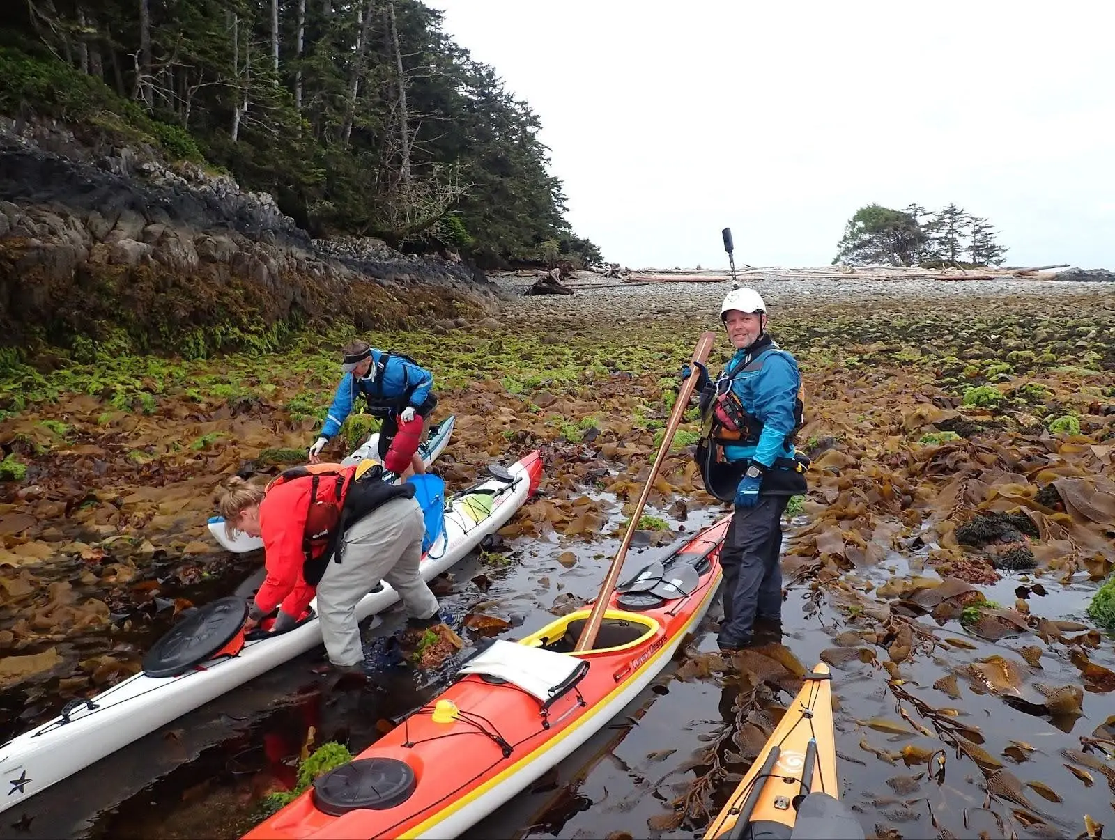
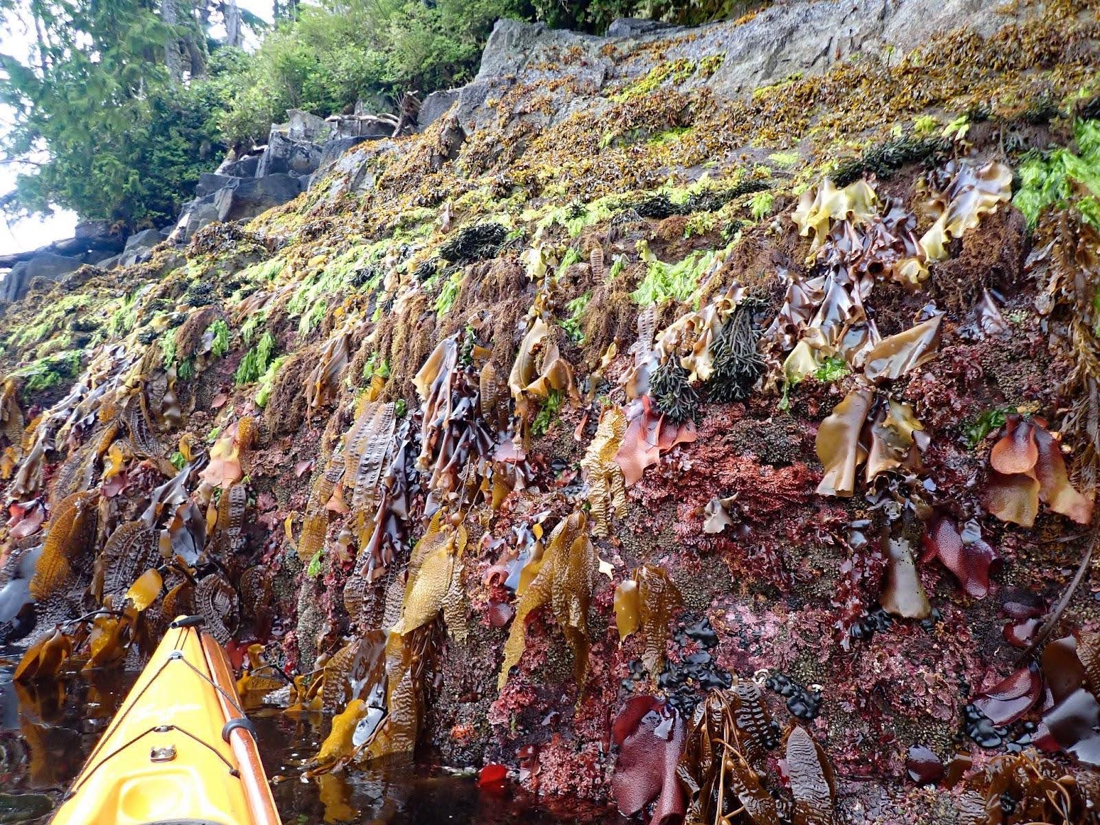
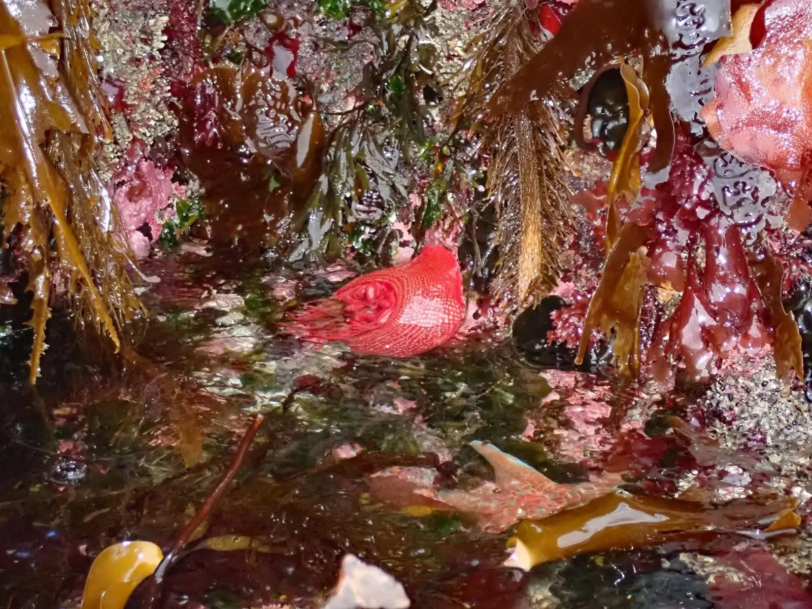
Spring low tide and launching on kelp
One of the most memorable moments at Table Island was the challenging 0 meter low tide launch at 8:30 am. The exposed kelp and slippery rocks made for a difficult gear carry and launch, the toughest we had encountered. Despite the treacherous conditions, we managed to launch by 8:45 am, and the intertidal zone revealed bright red anemones on the rocks as we departed.
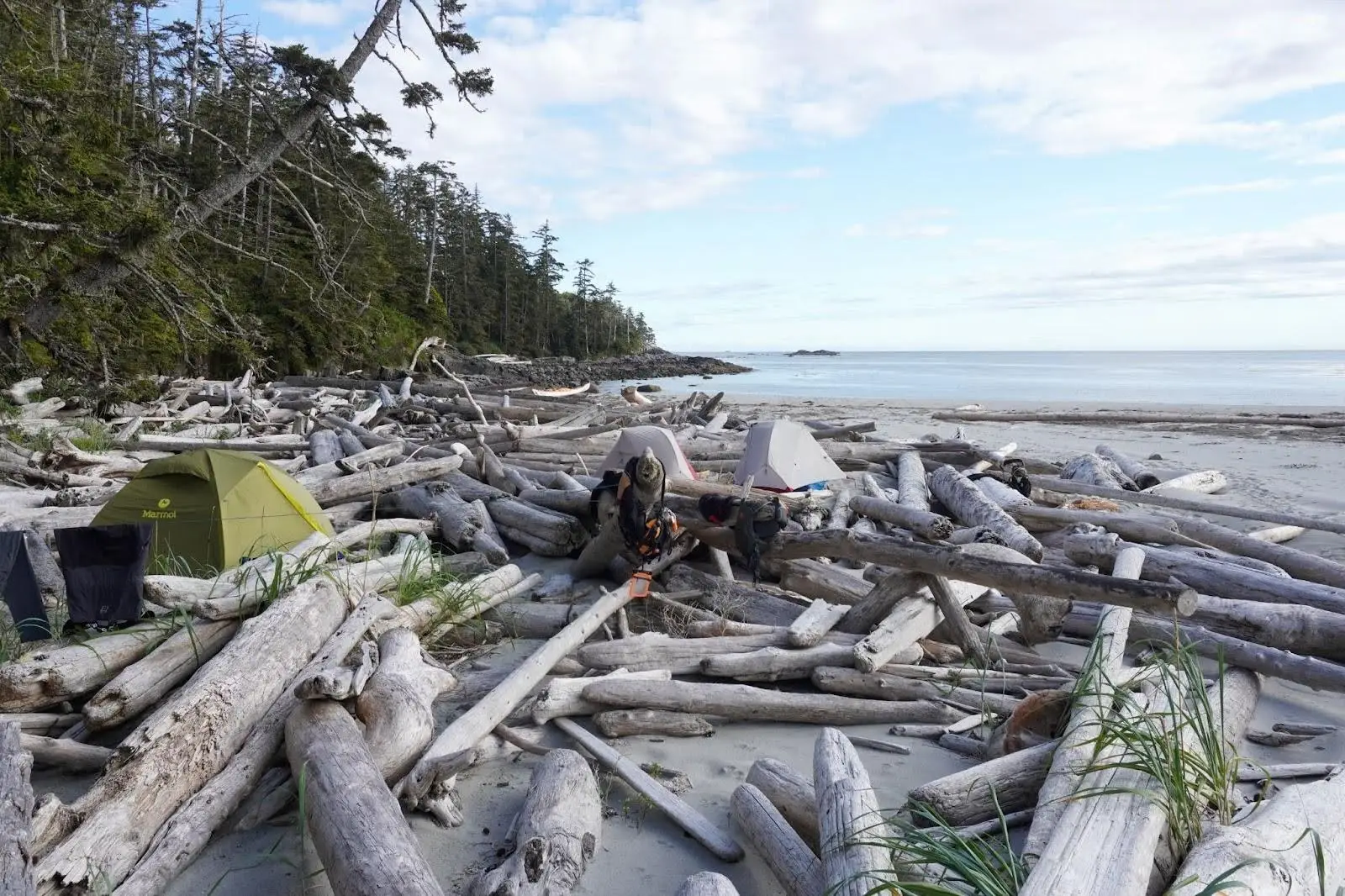
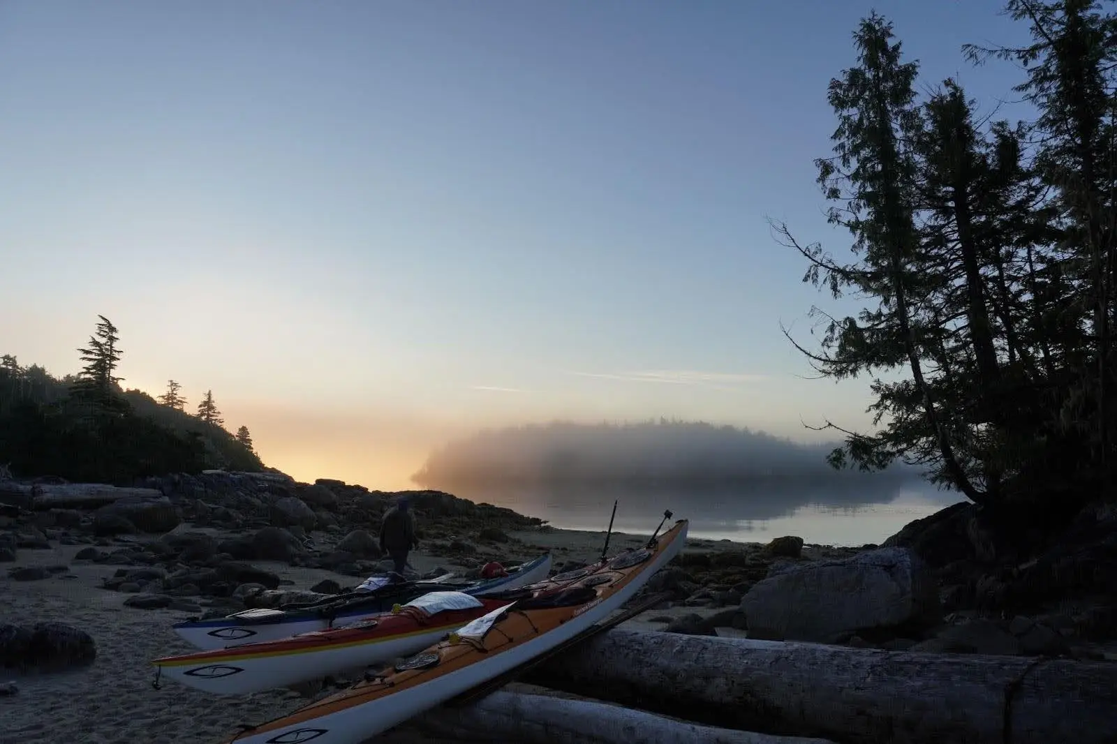
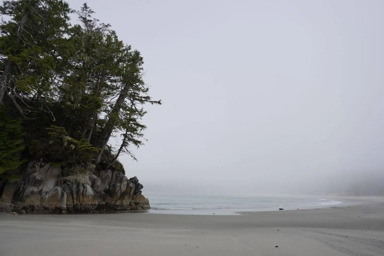
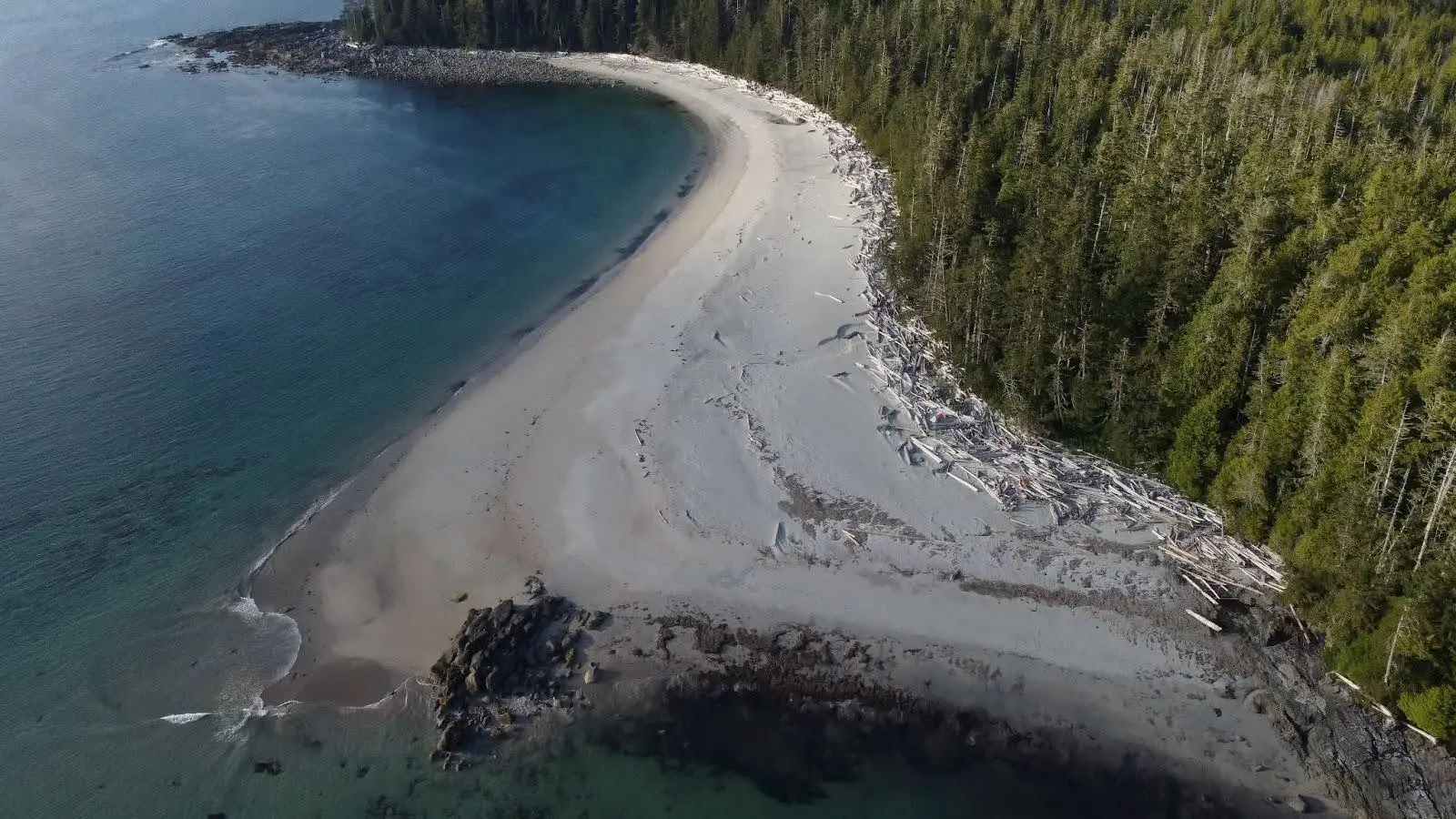
Stunning sandy beaches
A highlight of the trip was the stunning sandy beaches, despite my dislike of camping on sand. The beauty of the beaches at campsites and rest stops was breathtaking. Notable beaches included Burnett Bay (5 km stretch of sand), Dublin Point and West Beach on Calvert Island, and Serpent Island.
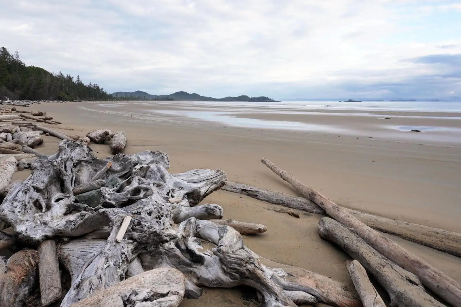
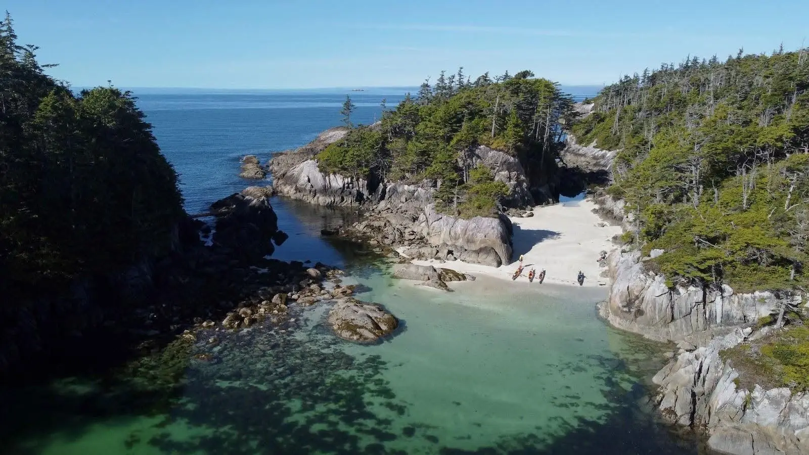
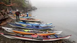
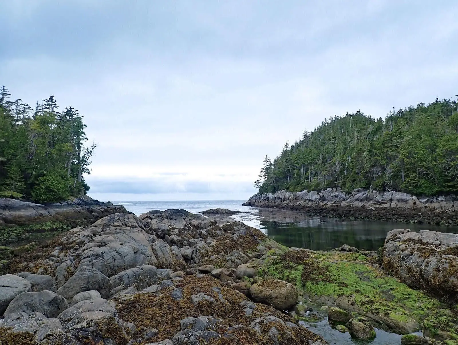
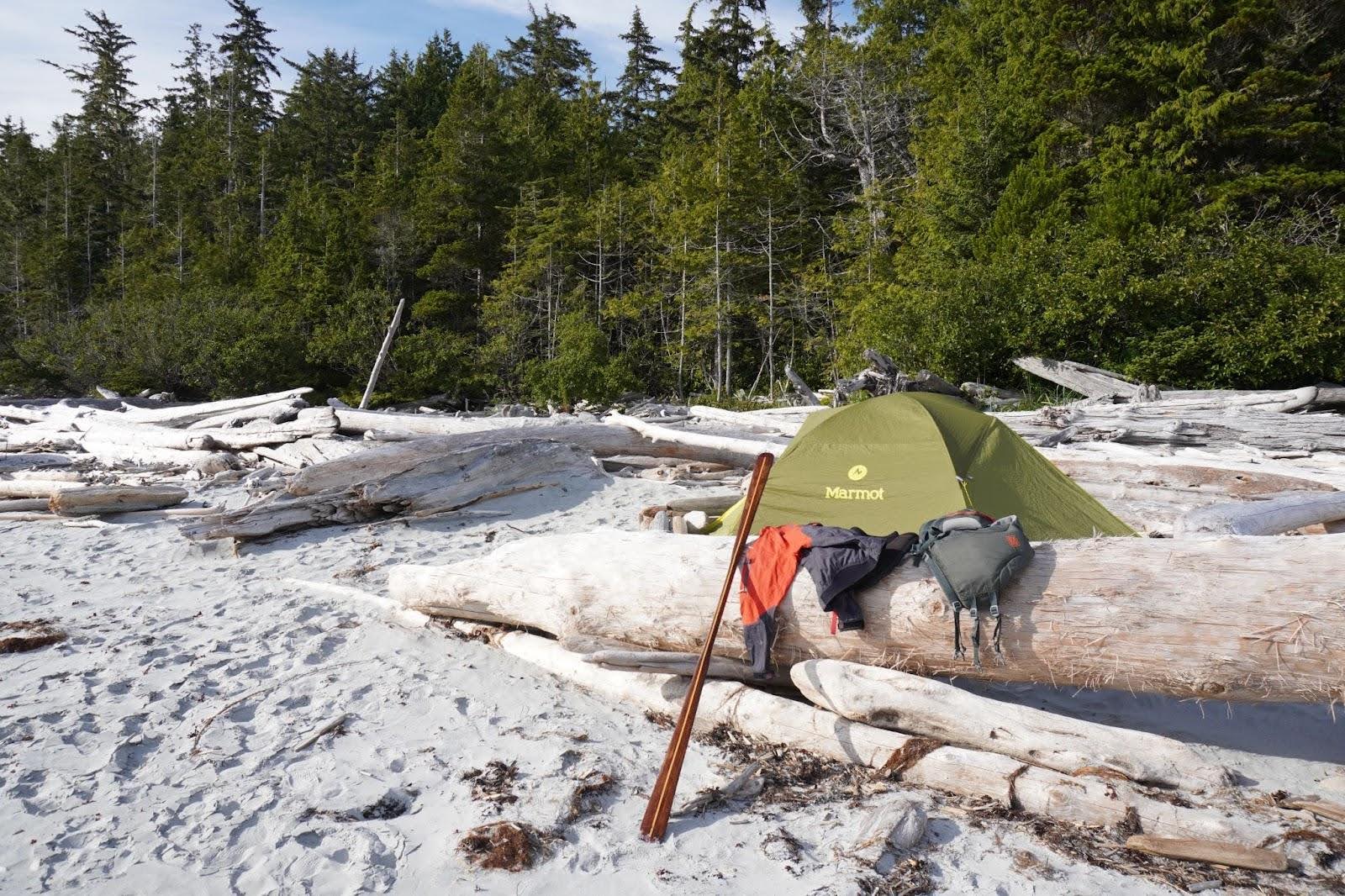
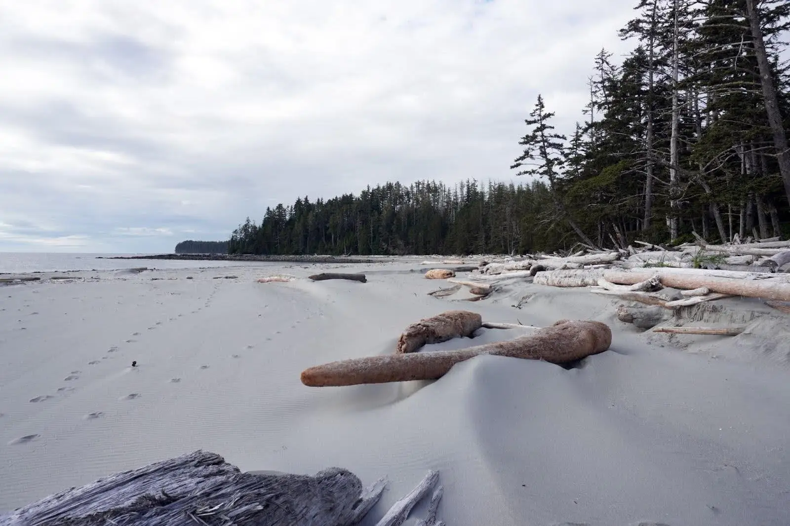
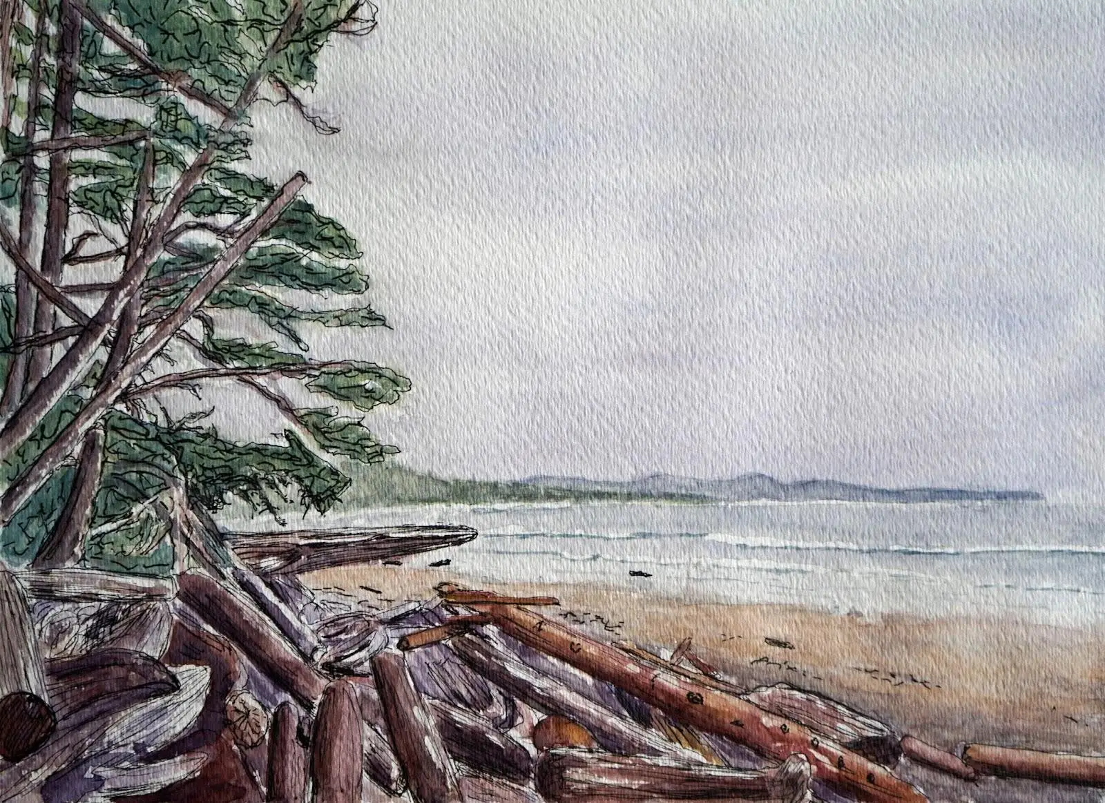
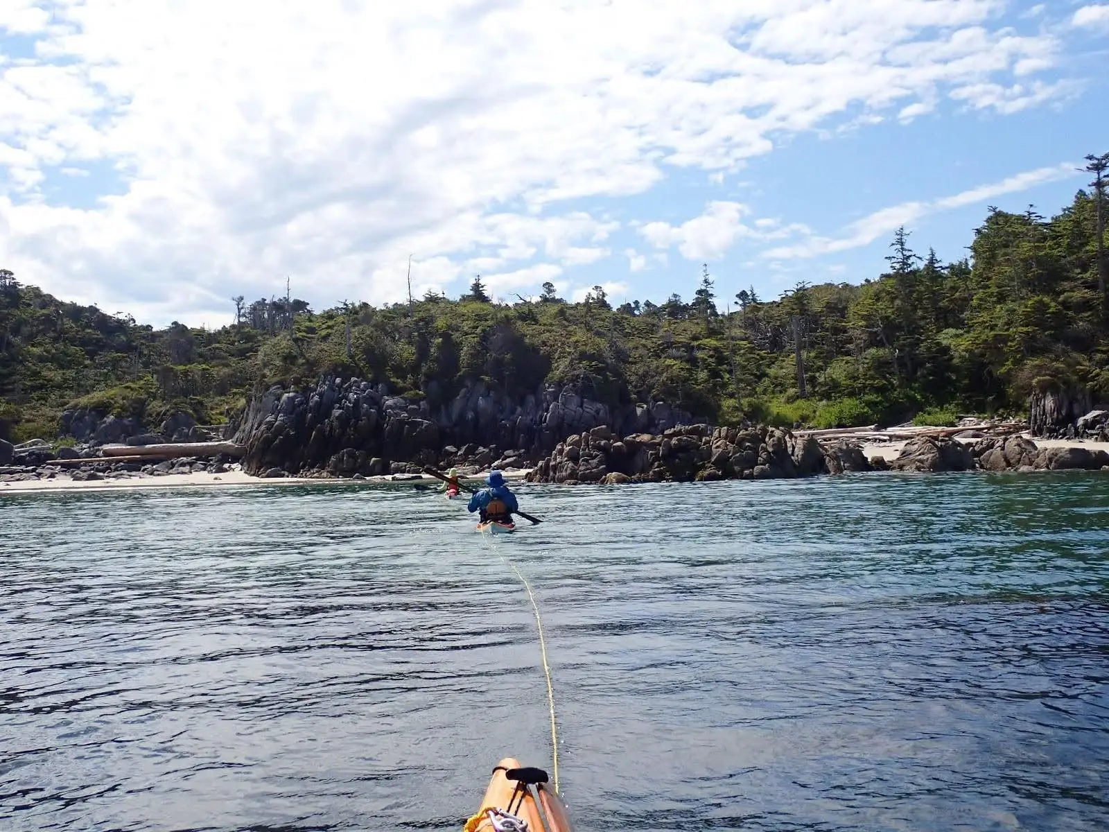
Discovering the enchanted remote coast
We camped with other kayakers at the first campsite out of Bella Bella (Soulsby) and at God’s Pocket at the end, experiencing complete remoteness in between. Blackney Island felt so remote, resembling the “edge of the world,” with driftwood, windswept sand, and animal footprints, and the only location for tents found between large masses of driftwood.
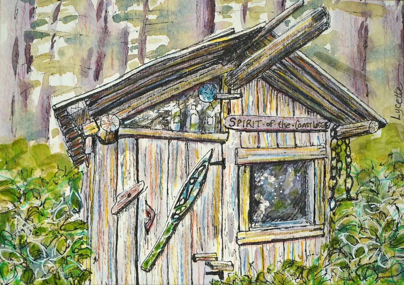
Spirit of the Coast Lodge
We landed at Burnett Bay (North) and discovered two small rustic cabins. On closer inspection we decided to stay in our tents as mice seemed like a problem in the cabins! Pat managed to fit his 1P tent inside one of the dwellings, the “Spirit of the Coast Lodge.” With a rainy rest day here, we read and signed the log books found in the cabin. It was cool to find logs as far back as 1993 and see messages written in previous years by people we personally know.
Site Assessments for BCMT
During the trip, I assisted BC Marine Trails by assessing potential sites on our route which I had marked on charts – places to potentially take breaks and evaluate. I completed 24 assessments, seven of which were on the list of “potential sites to be assessed,” while the others were official BCMT sites. I’m happy to have the opportunity to contribute to the BC Marine Trails map in a meaningful way. My method was good old pen and paper, as I updated my journal each night with notes about sites, took lots of photos, and then created the site condition reports once at home.
Was the trip a success after all the meticulous preparation?
Yes and no. A critical medical incident for me on Day 3 was a severe wrist inflammation, which was completely unexpected, proving that my fitness preparation was insufficient. The team’s extensive preparedness overall helped to manage the incident.
A contingency evacuation plan to hail a water taxi or seaplane via InReach was ready. I desperately wanted to experience the trip to the end, and so with great determination I continued, keeping my health in mind. After one rest day with icing and compression, followed by some towing, kinesiology taping, Advil, physiotherapy from Jenna, and a lighter carbon paddle (borrowed), I conquered the remainder of the expedition to Port Hardy.
With three fit paddling partners and a 50-foot tow belt each, a tandem tow system with alternating paddlers on Days 5 and 6 set the stage for me to start paddling solo from Day 7 for the Grief Bay to Kelp Head crossing. Eric towed for the final couple of miles on long days. The sea state throughout the trip helped to make towing possible and enabled me to keep a relaxed paddle pace and get to the much anticipated finish line – what a victory!
With a tremendous sense of achievement, our group accomplished the goal of a significant kayak expedition on the remote coast of BC. Completed two days ahead of schedule, the medical challenge proved that even meticulous preparation cannot guarantee immunity from unforeseen issues.
Nonetheless, it was an experience of a lifetime which has inspired each of us to build on the achievement and plan future North and Central Coast kayak expeditions.